Tuesday, November 23, 2021

Acadia 2021, Day 6 – a lake, a nubble, a bubble, and a pond

When planning out our activities in Acadia, I’d left an extra day free in case of bad weather or some things taking more time than expected. Because the weather mostly held, we ended up getting to everything on my list in five days, giving me a bonus day of hiking. After considering some options, we decided to explore the area north of Jordan Pond. Ideally, the plan was to drive to Jordan Pond, park there, take the Island Explorer bus to the Bubble Pond stop, and hike from there back to Jordan Pond via Eagle Lake, Conners Nubble, and the North Bubble. Fortunately, we found a parking spot at Jordan Pond, so the plan was a go.

The last time we were at Acadia, we actually tried to hike the Eagle Lake trail (also on my recommendation), but some way in it got too muddy and I we were forced to turn back. This time, we would need to make it the whole way through, mud or not, in order to get back to the car. The 1.8 mile trail starts out at the southeast corner of Eagle Lake, wraps around the southern end of the lake, and goes partway up the western shore. It starts out as a dirt trail, then as you pass the southern end of the lake the trail becomes rockier. Along the way, you get to see Eagle Lake, Conners Nubble to the west, and Cadillac Mountain to the east.

The south end of Eagle Lake.  The lump left of center should be Conners Nubble.

Eagle Lake from Conners Nubble

The Eagle Lake trail ends at the Eagle Lake Carriage Road, but shortly before intersecting the carriage road it connects to the Bubbles trail that leads to the North and South Bubbles via Conners Nubble. This is the trail we took, just as it began to rain. Fortunately, the showers didn’t last, and from Conners Nubble (588’), we got great views of all of Eagle Lake, Cadillac Mountain, Sargent Peak, and the North Bubble. From the nubble, we descended slightly back into forest before re-ascending to the North Bubble (872’). This section of the hike was about a mile and a half long and had some sustained inclines up the nubble and the bubble with a wooded relatively flat section between the two where you cross the carriage trail.


North Bubble from Conners Nubble

Jordan Pond and the South Bubble from the summit of the North Bubble

At the summit of the North Bubble, we got the view of Jordan Pond that we didn’t get when we were on the South Bubble a couple days previously, which was nice. By this time, the sky behind us was starting to look sketchy again, so we began our final descent along the Bubbles trail. Instead of taking the trail all the way back to Jordan Pond over the South Bubble, we cut around the South Bubble (to spare ourselves some climbing since we’d already been there) using the Bubbles Divide trail and the Jordan Pond Carry trail (~0.5 mi.). Once in the forest below the North Bubble, it darkened alarmingly, so we continued along somewhat hastily. The carry trail meets back up with the Jordan Pond trail at the same spot where the South Bubble trail does, and from there we had a final ~1.2 miles to the parking lot and the car. Although dark clouds hovered menacingly over the Bubbles* and there were a few raindrops and a fair amount of wind, it did not really rain on us, and we made it to the car without incident. And as we drove out of the park for the last time on this trip, we saw a rainbow over the ocean. So #blessed or something, right?

*I’m aware that the sky is very blue in most of the photos in this post. It really was quite dark in the opposite direction, I promise.

Trees

Rainbow

This hike was probably the quietest of any we took on this trip. We didn’t summit anything big, but we still got some nice views, explored a new part of Acadia, and did not get caught in a thunderstorm. It was a satisfying end to a pretty great trip.

Wednesday, November 17, 2021

Acadia 2021, Day 4 – Go West, Young Man

Most of the “main attractions” at Acadia – Sand Beach, Cadillac Mountain, Thunder Hole, Jordan Pond – are located on the east side of Mount Desert Island (MDI). However, after cross stitching the Bass Harbor Head Light, I had to go see it in person, and the Bass Harbor lighthouse is on the west side of MDI. While looking through the guidebook for potential hikes I also found some trails on the west side, so we decided to spend a day over on that half of the island and see what it had to offer.

We started out the day summitting the 681 ft. Acadia Mountain for views of Sommes Sound, the fjord that splits MDI into its two halves. The hiking was similar to what hiking in the northeast can often be like – wooded dirt paths on the flat, then a lot of rocks and stone steps when you’re climbing, often transitioning to bare rock at higher elevation. It was a relatively quick, if rocky, 0.7 miles to the summit, so I convinced everyone we opted to continue along the trail and loop back to the parking area instead of backtracking. The trail continues toward the sound for another quarter mile, giving more views of the fjord before descending into the forest down to Man of War Brook. From there, you can connect to the Valley Cove Trail that follows the shoreline of the sound (when it’s not closed for peregrine falcon nesting) or the Valley Peak Trail that leads up to St. Sauveur Mountain, but we took the Man o’ War Truck Road back out to where we had parked for a total loop distance of about 2.8 miles.

Sommes Sound

The guidebook also praised the views of Sommes Sound from Flying Mountain, so we headed there next. This was another quick hike, just 0.3 miles to the 284 ft. summit. The views were nice, especially for a spot that can be reached in ten minutes, but somewhat similar to those from Acadia Mountain. Flying Mountain is further south, and it’s lower in elevation, so you do get a closer look at the area around the sound and the view out to the ocean.

View from Flying Mountain

From Flying Mountain, we continued onward in the direction of the Bass Harbor Lighthouse, making two more stops along the way. The first was the natural Seawall, featuring lots of rocks and ocean waves. It’s apparently a good spot to watch the sunrise over Great Cranberry Island or stargaze, but we just stopped by to enjoy the rocks and waves before heading on our way.

Seawall

Our second stop was Wonderland. With a name like Wonderland, how could we not stop? We made the (fortunately not serious) mistake of not actually checking how long the trail was (it looked short on the map and was wide and flat) and it turned out to be longer than it looked (0.7 miles one way), but it was fine. Wonderland is one of the main spots known for tide pools at low tide, but as usual we weren’t scheduling anything by the tides and we were there at the wrong time, though there were still a couple pools. I managed to see a few small fish, a couple snails clinging to the rocks, and a mini crab or two.

Wonderland

Finally, we made it to the destination that was the original reason for visiting this half of MDI, the Bass Harbor Head Light, just in time for the fog to roll in again. Yes, really. During the summer, the sun sets behind the lighthouse, which can produce some very nice photos, assuming the sun is actually visible. Which it was most definitely not on this day. Still, I got to see the lighthouse, and earlier in the day enjoy tide pools and a fjord, so I’m not complaining. Too much.

Bass Harbor Head Light

Wednesday, November 10, 2021

Acadia 2021, Day 3 – Jordan Pond

Day three of our trip took us to Jordan Pond. It was another marginal weather day, so we had planned to stop by the visitor center, then take the Island Explorer bus and try to get lunch at the Jordan Pond House. At this point in time, the Hulls Cove Visitor Center was open and requiring masks for everyone indoors, and they also had an outdoor tent station with park rangers answering questions. Inside, the visitor center had been reconfigured (as of winter 2019) since the last time we were at the park. Sadly, they no longer air the park film, which is a pity because there’s nothing quite like an educational National Park Service produced video to supplement your trip.1 The store was moved into the old auditorium space and seems to carry fewer items, maybe thanks to online shopping and the internet. For what it’s worth, I planned out all our hikes using a physical book and map because 1) yes, I can still read a paper map (and an analog clock, for that matter), and 2) cell service in Acadia isn’t reliable once you go too far south on Mt. Desert Island.

As we were leaving the visitor center to catch the bus, we found out that the Jordan Pond House was closed for rest of the day unexpectedly, with no news on when it would reopen. They weren’t saying it, but the sudden unplanned closure pointed to Covid. We made the decision to go to Jordan Pond anyway and walk around the pond and up the South Bubble, a hike that we usually do when we go to Acadia. From the Jordan Pond House at the south end of Jordan Pond, you can either circle the pond clockwise or counterclockwise. The east side is flatter with dirt trails while the west side is more rugged with the trail either on bare rock or boardwalk. At the north end of the pond, you can connect to the hiking area around the Bubbles. The shoreline trail is about three and a half miles long, and the spur up to the South Bubble adds another ~1.2 miles.

Fog on Jordan Pond

As per usual, we set off counterclockwise up the eastern shore first. Similarly to the previous day, there were visibility issues, but at least it made for some interesting pictures. Because of its location and relative flatness, especially on the east shore, Jordan Pond is one of the busier hiking destinations in Acadia, which I found to be true, but I’ve heard about trails where there are so many people it’s like walking in a very long line, and it was definitely not that bad. At the northern end of the pond we took the trail up the South Bubble, which is also where Bubble Rock is. There were exactly zero views of Jordan Pond or anything else to be had, but we took the traditional photos of trying to push Bubble Rock over2, enjoyed a snack, and headed down.

Bubble Rock (also sometimes referred to as Balance Rock)

Shadows in the fog

Back on the shores of Jordan Pond, we completed our circuit of the pond, caught the bus (free, multiple routes, masks required onboard during Covid) back to the visitor center, and got our standard photo at the park sign (which was also new). Another day at Acadia done.

More fog; the Bubbles should be visible right in the middle of the photo

1I was in elementary school before the existence of YouTube. We watched a lot of clearly made-for-education VCR tapes on CRT TVs strapped to carts that were rolled around the whole school as required. I still know the Preamble to the U.S. Constitution thanks to the Schoolhouse Rock! song.

2Estimating the size of Bubble Rock as a rectangular prism slightly less than twice as high and wide as a person and 2-3 times as long gives a volume of 960 ft3 (~8 ft x 8 ft x 15 ft) which is 27.2 m3. Assuming it’s granite, granite is about 2.7 times as dense as water, 2700 kg/m3, for a weight of 73,300 kg, or 161,000 lb. – over 80 tons or 40-55 cars, so it’s probably not going to be pushed over by any given person any time soon.

Thursday, October 21, 2021

Acadia 2021, Day 2 – Ocean Path

After hiking Cadillac Mountain on day 1 to “get it over with” (an anonymous family member’s words, not mine), I had planned for day 2 to be less strenuous, plus the weather was questionable so I didn’t want to tackle anything too ambitious. It was, in fact, raining when we made it into Acadia, but it let up enough for my family to agree to go on a walk along the Ocean Path. The Ocean Path is about 2 miles long (one way) and connects Sand Beach to Otter Point, passing by Thunder Hole on the way. It’s mostly flat, you can turn back at any time, and you get views of the ocean and coastline so it’s a good choice for people who don’t have much time in the park or aren’t interested in climbing anything.

The Acadia coastline

We started out at the Sand Beach parking lot. The beach, shockingly enough, was not filled with sunbathers and children building sandcastles but a small crowd wearing raincoats, carrying umbrellas, and gazing desultorily out at the waves. After walking up and down the beach to admire the sand and surf, we headed off on the Ocean Path. We explored the rocks along the coast as we went, and eventually made it to Thunder Hole, about a mile from the beach. Thunder Hole is a rock inlet where the waves are supposed to rush in, make loud booming noises, and create lots of spray. It’s best visited as the tide is coming in (and during bad weather, but if it’s too bad the park rangers close off access), and we were there an hour after high tide, so there was no thundering, but there was some gurgling.

The Beehive (I think) from Sand Beach

Thunder Hole

From Thunder Hole we continued down the Ocean Path. Most of the time the path follows the Park Loop Road, the scenic road in Acadia that passes by most of the major attractions in the park, but there’s a wooded part further from the road in this section, which is also where the fog really started rolling in. By the time we made it to Otter Point, we’d more or less lost any view of the ocean. Better this day than when we were hiking Cadillac, I guess. At this point, we hiked back to Sand Beach, got into the car, and drove off to get lobster for dinner, because what’s a trip to Maine without at least one lobster dinner?

Fog on the Ocean Path

Tuesday, October 5, 2021

Acadia 2021, Day 1 – Cadillac Mountain

Before it became trendy for the Instagrammers1 and hipsters and bandwagon outdoorspeople to pack up their iPhones, $300 backpacks, and brand new hiking boots and take to the hills and dales, my family was enjoying hiking and camping because it was cheap. And fun. I’m absolutely not judging who is or isn’t a “true” hiker, but do it because you like it, not because you want social media clout or because everyone else is doing it. And please, please, do some research and don’t do something like show up to climb Katahdin at 2 pm wearing crocs and carrying a single 8 oz. bottle of water that belongs in an elementary schooler’s lunch box.2 With that said, on to the actual subject of this post.

Part of my trip home was a family vacation to Acadia National Park, in Maine. Acadia is the only national park in the northeast, and even the last time we were there in 2013, the park rangers were already saying that attendance was rapidly increasing. Thanks to social media, covid, and probably some other factors, when we were there this time, it was downright crowded (in certain areas; others weren’t too bad). Still, we had a good trip, and I think I’m happy with my new wide angle lens.

I (somehow?) was allowed to be in charge of planning our hiking excursions, but because I know not everyone’s idea of a good time is hiking all day, every day, we didn’t do anything too crazy. At least in my opinion. Our first hike was up Cadillac Mountain, at 1,528 ft the highest point on Mount Desert Island. Due to the increased crowds, you now have to reserve a parking pass to drive up Cadillac, but hiking doesn’t require a permit. Previously, we hiked Cadillac via the Gorge Trail (up) and the North Ridge Trail (down). We got caught in the rain and got views of nothing but clouds from the summit. This time, we were about to tackle Cadillac from the South Ridge Trail, which is longer but less steep.

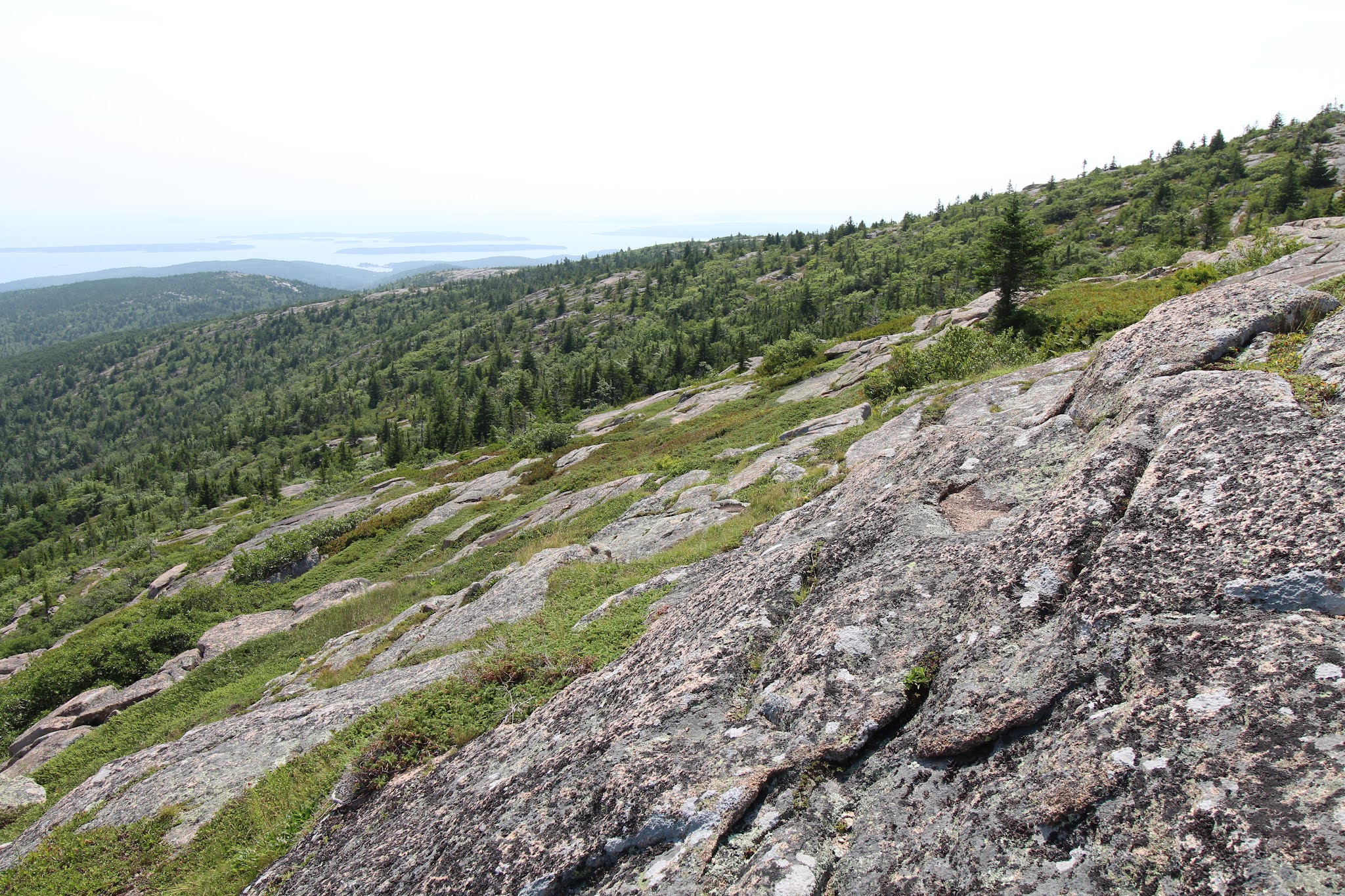
We parked by the trailhead, I made everyone peanut butter and jam sandwiches, and we headed off on our adventure of the day. The first mile+ is wooded and (comparatively) gently sloping. For the next ~two miles, the trail is on rock surrounded by shrubs and small trees. First you follow a long ridge with lovely views on either side (the Atlantic Ocean to the right/east and further into the park on the left/west) and the summit ahead. That’s followed by a short descent down to a little pond called the Featherbed, then an ascent back up to another rock slope. The final half mile returns to the trees (what, you thought any of these little east coast peaks would get above treeline?) and roughly parallels the summit road close enough that you can both hear and see cars, which is a little annoying, but the earlier views more than made up for it.
 
Ascending Cadillac on the South Ridge Trail

The Featherbed

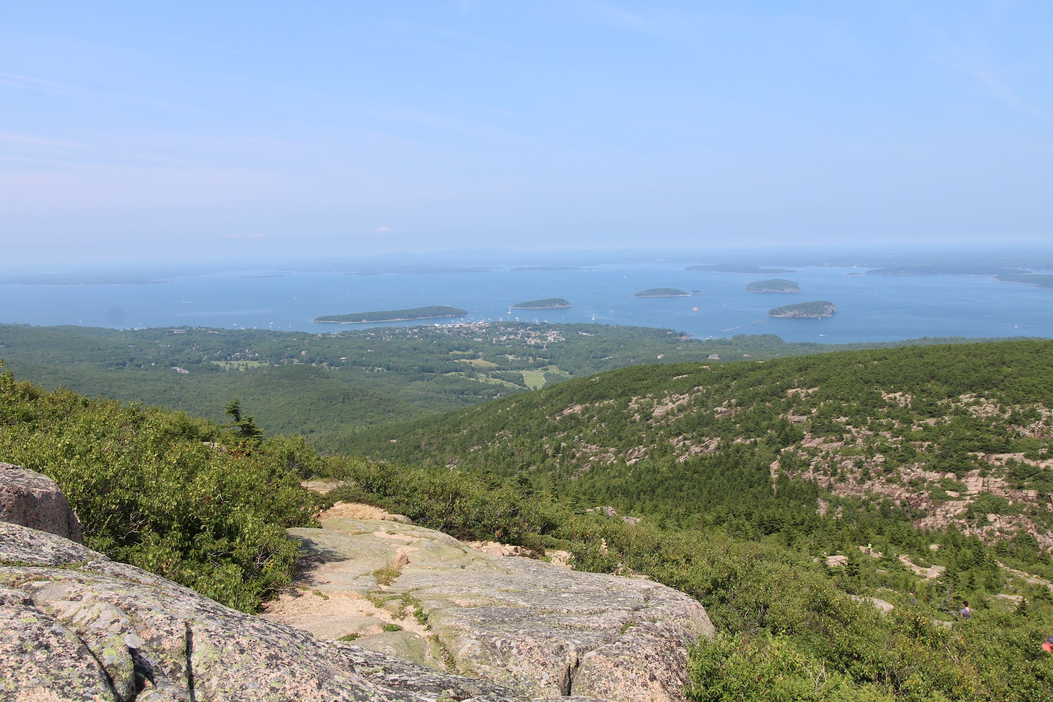
When we made it to the summit area, we found a spot to enjoy the view and lunch. As per usual, the vistas looked better and the meal tasted better because we hiked to get there.3 After eating, we walked around the summit to get the views of Champlain Mountain and Bar Harbor, then headed back down the mountain the same way we came up. At seven miles roundtrip, the South Ridge Trail is longer than your average casual “hey, let’s go for a hike” kind of hike, but the views really are quite delightful.

There were a couple sections that I would consider truly steep; other than those brief segments it’s mostly just a continuous climb with a little down and up around the Featherbed in the middle. We had pretty good weather, clear skies, a little hazy, not too hot, not too many bugs; the trail itself wasn’t too crowded (the summit was busy, and the store was pretty packed); and all in all it was a great start to our Acadia vacation.

Views from the summit

Bar Harbor, Bar Islands, and Champlain Mountain

Descent, looking out to the Atlantic

1Welcome to 2021, where Instagrammers is a word according to spell check and prefactor and rheometry aren’t. At least the opposite is true in the OED.

2Katahdin takes 8-12 hours to hike, is known for being rough on hiking boots (so just imagine what it would do to soft rubber shoes), and it’s recommended to bring half a gallon of water per person. Baxter State Park also requires every hiker to have a flashlight that’s not your phone and another of the items on their packing list is an emergency blanket in case you get stuck on the mountain overnight. So no, you don’t just waltz right up for that cool money shot on the Knife Edge.

3I’m pretty sure this is a proven scientific fact.