Showing posts with label vacation. Show all posts

Saturday, June 25, 2022

Sleeping Bear Dunes, part 2

For the second half of the trip, I had a couple more hikes planned. In the morning, after another round of sandwich making, we headed out for Alligator Hill. Alligator Hill has a total of nine miles of trails divided into three loops. We took the shortest loop to the Islands Lookout and back with a detour along the spur to the Big Glen Lookout, for a total of 4.3 miles, our longest single hike of the trip. The internet told me that Alligator Hill was a fun hike with great views of Lake Michigan and Glen Lake, but especially after the previous day the views were good but not amazing.

On the trail at Alligator Hill

The dirt trail is mostly wooded, and Alligator Hill is indeed a hill, so there is some ascending/descending, but nothing overly strenuous. After 1.3 miles, you reach the Islands Lookout which does give nice views of Lake Michigan, including North and South Manitou Island. While we were stopped to snack on bananas and take photos, we saw a bald eagle in the wild for the first time, and I did get a not entirely in focus picture with my telephoto lens. Shortly after that point, we turned off the main trail to the Big Glen Lookout. It was a 1.6 mile detour, and when we got to the clearing in the trees I’m not sure I can say it was really worth it. About all I can say about it is that it was a view of a lake.

View from the Islands Lookout

Back at the parking lot after a couple hours+, we piled back into the car and drove to the Dunes Trail to have lunch at the picnic area there. From there, we continued on to the last hike I had planned, Pyramid Point. Pyramid Point is another short trail that leads to a view of Lake Michigan. There’s a 2.7 mile loop, but we just did the 0.6 miles (one way) to the lookout and back. At the lookout, we had more large bird sightings – a small group of turkey vultures and a likely red-tailed hawk (the red tail was not visible in the photo I got). We took about an hour to hike up to the lookout, enjoy the lake from the top of the bluff, and hike down from the lookout.

View from Pyramid Point

At that point, it was midafternoon, and we’d completed all the hikes I had planned for us, so we drove around for a bit, stopped in Glen Haven (a former company town where you can still see the general store, cannery-turned-boathouse-museum, and blacksmith shop), then returned to the Airbnb early. After dinner, we walked to the beach for a Lake Michigan sunset, then closed out the night by watching Shrek Forever After.

From left to right: bald eagle, turkey vultures, red-tailed hawk

Sunset over Lake Michigan

We probably could have fit more into the trip, but we saw most of the main attractions, except maybe really getting to enjoy the beach and I’ve heard the Maritime Museum is interesting. It felt cooler than my Upper Peninsula trip back in October, but it didn’t rain. I’m really not a huge food/shopping person, so I didn’t mind the tradeoff of closed stores for no crowds. I shot the whole trip on my T6 with an ultrawide (10-18mm) and a telephoto (55-250mm) lens, and I think it works well for hiking trips, possibly not as good if we had been indoors more/at all. Overall, it was a good trip.

Tuesday, June 21, 2022

Sleeping Bear Dunes, part 1

Before leaving Ann Arbor, we took a quick family vacation to the west side of Michigan to see the Sleeping Bear Dunes, another one of the things you should probably see if you lived in Michigan for six years. Like Pictured Rocks, Sleeping Bear is National Lakeshore managed by the U.S. National Park Service; a weeklong pass for a private vehicle costs $25. We spent two full days at Sleeping Bear, and did four of the hikes in the Lakeshore, which covered most of the highlights of the area – climbing the dunes, spending some time on a Lake Michigan beach, and getting various views of the lake and dunes.

Our first day was primarily a travel day – we left Ann Arbor bright and more or less early, picked up my brother and his girlfriend in Kalamazoo, and arrived in Glen Arbor midafternoon after a stop for a lunch of pasties1 (another Michigan thing to try before leaving), an apple dumpling, and apple blueberry pie. The Airbnb we stayed at in Glen Arbor was nice, even if I was literally sleeping behind the closets of both actual bedrooms. After checking in and unpacking a little, we went out to explore Glen Arbor, walked to the beach, and had dinner at Cherry Republic.
 
Dunes Trail with Lake Michigan in the distance

The next morning, we set out on our second longest but most challenging and probably also most iconic hike, the 3.5 mile (round trip) Dunes Trail up the Dune Climb to Lake Michigan. We were at Sleeping Bear the weekend before Memorial Day, before the official tourist season started. Some amenities and restaurants were still closed for the winter, but enough was open that it was worth not dealing with crowds anywhere. The weather was cool (highs close to 289 K2) but clear throughout the entire trip, so shorts and jacket weather, plus extra jacket + glove-mittens for the wind off of Lake Michigan. There were about three cars in the parking lot when we got to the Dune Climb, and we eventually encountered a half dozen or so groups of people on our way to the lake.

The initial climb is the longest sustained incline, but you do have to climb and descend four more dunes on the way to Lake Michigan. The sand is indeed coarse, rough, and everywhere, but wasn’t too irritating. The entire route is on sand, though you pass through areas with dune grass, flowers, and small trees, and though the way is mostly straightforward, it’s marked with blue-tipped poles to steer people away from alligators areas where they’re trying to prevent erosion. At a fairly leisurely pace and stopping a lot to take photos, it took us about eighty minutes each way. We had lunch, part 1, when we got to Lake Michigan, where it was windy and cold, so we didn’t explore the water much. Back at the parking lot, we had lunch part 2, featuring more of my favorite vacation anytime food, peanut butter and jam sandwiches.

At Lake Michigan at the end of the Dunes Trail

After lunch, we stopped by the main visitor center, the Philip A. Hart Visitor Center, to pick up a park pass, map, and stamp, then continued on to our second hike of the day, the Empire Bluff Trail. The internet told me this was one of the most popular trails, so I guess we had to do it. It’s a relative quick 1.5 mile hike that goes through forest before coming out on a boardwalk that boasts views of Lake Michigan and the lakeshore. It was nice, worth doing, and only takes about an hour of your time.

View from Empire Bluff Trail

Finally, we drove the Pierce Stocking Scenic Drive, a 7.4-mile loop with a dozen stops where you can get out for photos, though a few of the stops appeared to have views of nothing but trees. When we were there, I believe the drive had just opened for the summer (it’s closed in the winter). You are allowed to bike it, though the NPS website advises only expert cyclists to attempt it. The overlooks, complete with informational signs, provide views of Lake Michigan, the dunes, and the Glen Lakes, and there are also some hikes and picnic areas that are accessed from the drive. We spent about an hour and a half driving, stopping, getting out of the car, enjoying the views, getting back in the car, etc. before heading back to our Airbnb for the night. All in all, it was a successful first day of our trip.

At the Lake Michigan Overlook on Pierce Stocking Drive

1A pasty is a hand pie filled with meat and root vegetables (potatoes, rutabaga, etc.) brought to Michigan from Cornwall.

260 F/16 C

Thursday, December 16, 2021

Mount Wachusett

Last post from my trip home to New England, then I plan to post some non-travel related things before getting into my fall trip. Perhaps to make up for the past 5 years of walking in circles in flatland Michigan and 20 months since my brother and I had been home, we did a fair amount of hiking and other outdoor activities in a relatively short time span. The last hike we took shortly before I flew back to Ann Arbor to finish up my degree was up Mount Wachusett.

This was a quick hike up the 2,006 ft. Mount Wachusett in central Massachusetts. In winter, people go to Mt. Wachusett to ski, but during the rest of the year the state reservation is open for hiking. There is a separate visitors center for hikers, but we parked at the ski area parking lot because it’s free in summer. From the parking lot, we took the Balance Rock Trail, connected to the Old Indian Trail to the summit, then came down the Loop Trail to the visitor center and used the Donbrowo Trail to get back to the ski area. This loop is about 3 miles long and can be hiked in under a couple hours pretty easily.

Balance Rock

Like most of the rest of our hikes this summer, it was rocky. The trail is wooded and relatively flat up to Balance Rock, which, as you may have guessed, is a rock balanced on another rock. From Balance Rock, the trail starts to ascend more steeply up rock fields, occasionally crossing the ski trails. Near the summit, you emerge from a wooded section at the top of one of the ski lifts, nonoperational during the summer. At the summit, there’s a fire tower with a lower platform accessible. Depending on the day’s visibility, you can see a number of the surrounding hills/mountains, including Mt. Monadnock and the Berkshires. If it’s a really clear day, it’s possible to see the Boston skyline sixty miles to the east.

Ski lift

Summit fire tower

On the way down, we took a different route, which involved crossing and walking along the summit road for a portion of the descent. This trail was steeper than our ascent, so had stone steps for most of the trail. We stopped in at the visitor center to look at some of the educational exhibits on the flora and fauna found on the mountain, then took the flat Donbrowo Trail back to the ski area. At the end of summer, the ski lodge and surrounding accessory buildings were locked and silent, the ski lifts unmoving. There did appear to be an event being set up, but we weren’t invited, so we returned to the car and picked up Chinese takeout for dinner, which we enjoyed with some Long Trail Ale, probably my favorite beer since I picked it up in a Wegmans pick your own 6 pack during college.

View from an overlook on the descent

Tuesday, November 30, 2021

Acadia 2021 – Day 5 and Homeward Bound

I did not forget about day 5. On day 5, we made it to the Jordan Pond House for lunch, then revisited Sand Beach and the Ocean Path on a day when we could actually see the beach and the ocean. I’ve already talked about Jordan Pond and the Ocean Path, so I don’t have much else to add but some new pictures not filled with fog and a lunch report.

Oh hello, Bubbles

Jordan Pond House

The Jordan Pond House was open, but appeared to be operating at reduced capacity and possibly also with a pared down menu. We had about an hour wait, which we spent around Jordan Pond enjoying being able to see the pond (and even the Bubbles across the pond, imagine that). When we were summoned for our late lunch, there were a few parties seated indoors, but as usual we chose to sit outside on the lawn. The Jordan Pond House is known for popovers, so we ordered popovers with jam and butter, then I had shepherd’s pie. [Made with lamb. Technically if it contains ground beef instead of lamb it’s supposed to be called cottage pie, but especially in the US and on school lunch menus it’s often still called shepherd’s pie even if it’s made with ground beef.] Lunch was good, with a good view, and following the meal we headed back to Sand Beach to enjoy the coast for an hour or so.

Sand Beach from the Ocean Path

It was a pretty relaxed day, then the following day, our last in Acadia, I dragged everyone on one last hike involving multiple bodies of water, multiple prominences, and multiple peanut butter and jam sandwiches, as chronicled in my previous post. The last day of our trip, we packed, cleaned our lodgings, and I drank most of the remaining milk straight from the carton because no one else would.

On the way back home, we made a stop in Portland (ME, not OR) to explore the downtown/harbor area a bit and then see the Portland Head Light, another lighthouse popular with photographers (for good reason; it’s a very photogenic lighthouse).

The Portland Head Light, completed in 1791, is Maine’s oldest lighthouse, and is likely the inspiration for Henry Wadsworth Longfellow’s poem “The Lighthouse.” It’s located in Fort Williams Park, which is itself a very nice park. Besides the lighthouse, there are walking trails along the ocean, the remains of Fort Williams, grassy fields for kite flying, picnic areas, and various other recreational facilities. It was a good stop on the way home to break up the drive (which wasn’t that long – we drove from New England to Florida all the way down I-95 when I was in high school).

Portland Head Light

By the end of the trip, we ended up covering somewhere north of 30 miles on foot over six days, with a decent amount of elevation change. I’m still a little surprised I was allowed to plan all our hiking, and everyone seemed to put up with it, but I guess the real test is if I’m allowed to plan all our hiking on the next trip. During the trip, I also made up to twenty-four peanut butter and jam sandwiches, took 752 photos (currently culled to 555), and finished reading my second Jane Austen novel (Pride and Prejudice, after previously having listened to Persuasion). Overall, I’m glad I managed to make it home and (finally) do some “real” hiking for the first time in awhile.

Tuesday, November 23, 2021

Acadia 2021, Day 6 – a lake, a nubble, a bubble, and a pond

When planning out our activities in Acadia, I’d left an extra day free in case of bad weather or some things taking more time than expected. Because the weather mostly held, we ended up getting to everything on my list in five days, giving me a bonus day of hiking. After considering some options, we decided to explore the area north of Jordan Pond. Ideally, the plan was to drive to Jordan Pond, park there, take the Island Explorer bus to the Bubble Pond stop, and hike from there back to Jordan Pond via Eagle Lake, Conners Nubble, and the North Bubble. Fortunately, we found a parking spot at Jordan Pond, so the plan was a go.

The last time we were at Acadia, we actually tried to hike the Eagle Lake trail (also on my recommendation), but some way in it got too muddy and I we were forced to turn back. This time, we would need to make it the whole way through, mud or not, in order to get back to the car. The 1.8 mile trail starts out at the southeast corner of Eagle Lake, wraps around the southern end of the lake, and goes partway up the western shore. It starts out as a dirt trail, then as you pass the southern end of the lake the trail becomes rockier. Along the way, you get to see Eagle Lake, Conners Nubble to the west, and Cadillac Mountain to the east.

The south end of Eagle Lake.  The lump left of center should be Conners Nubble.

Eagle Lake from Conners Nubble

The Eagle Lake trail ends at the Eagle Lake Carriage Road, but shortly before intersecting the carriage road it connects to the Bubbles trail that leads to the North and South Bubbles via Conners Nubble. This is the trail we took, just as it began to rain. Fortunately, the showers didn’t last, and from Conners Nubble (588’), we got great views of all of Eagle Lake, Cadillac Mountain, Sargent Peak, and the North Bubble. From the nubble, we descended slightly back into forest before re-ascending to the North Bubble (872’). This section of the hike was about a mile and a half long and had some sustained inclines up the nubble and the bubble with a wooded relatively flat section between the two where you cross the carriage trail.


North Bubble from Conners Nubble

Jordan Pond and the South Bubble from the summit of the North Bubble

At the summit of the North Bubble, we got the view of Jordan Pond that we didn’t get when we were on the South Bubble a couple days previously, which was nice. By this time, the sky behind us was starting to look sketchy again, so we began our final descent along the Bubbles trail. Instead of taking the trail all the way back to Jordan Pond over the South Bubble, we cut around the South Bubble (to spare ourselves some climbing since we’d already been there) using the Bubbles Divide trail and the Jordan Pond Carry trail (~0.5 mi.). Once in the forest below the North Bubble, it darkened alarmingly, so we continued along somewhat hastily. The carry trail meets back up with the Jordan Pond trail at the same spot where the South Bubble trail does, and from there we had a final ~1.2 miles to the parking lot and the car. Although dark clouds hovered menacingly over the Bubbles* and there were a few raindrops and a fair amount of wind, it did not really rain on us, and we made it to the car without incident. And as we drove out of the park for the last time on this trip, we saw a rainbow over the ocean. So #blessed or something, right?

*I’m aware that the sky is very blue in most of the photos in this post. It really was quite dark in the opposite direction, I promise.

Trees

Rainbow

This hike was probably the quietest of any we took on this trip. We didn’t summit anything big, but we still got some nice views, explored a new part of Acadia, and did not get caught in a thunderstorm. It was a satisfying end to a pretty great trip.

Wednesday, November 17, 2021

Acadia 2021, Day 4 – Go West, Young Man

Most of the “main attractions” at Acadia – Sand Beach, Cadillac Mountain, Thunder Hole, Jordan Pond – are located on the east side of Mount Desert Island (MDI). However, after cross stitching the Bass Harbor Head Light, I had to go see it in person, and the Bass Harbor lighthouse is on the west side of MDI. While looking through the guidebook for potential hikes I also found some trails on the west side, so we decided to spend a day over on that half of the island and see what it had to offer.

We started out the day summitting the 681 ft. Acadia Mountain for views of Sommes Sound, the fjord that splits MDI into its two halves. The hiking was similar to what hiking in the northeast can often be like – wooded dirt paths on the flat, then a lot of rocks and stone steps when you’re climbing, often transitioning to bare rock at higher elevation. It was a relatively quick, if rocky, 0.7 miles to the summit, so I convinced everyone we opted to continue along the trail and loop back to the parking area instead of backtracking. The trail continues toward the sound for another quarter mile, giving more views of the fjord before descending into the forest down to Man of War Brook. From there, you can connect to the Valley Cove Trail that follows the shoreline of the sound (when it’s not closed for peregrine falcon nesting) or the Valley Peak Trail that leads up to St. Sauveur Mountain, but we took the Man o’ War Truck Road back out to where we had parked for a total loop distance of about 2.8 miles.

Sommes Sound

The guidebook also praised the views of Sommes Sound from Flying Mountain, so we headed there next. This was another quick hike, just 0.3 miles to the 284 ft. summit. The views were nice, especially for a spot that can be reached in ten minutes, but somewhat similar to those from Acadia Mountain. Flying Mountain is further south, and it’s lower in elevation, so you do get a closer look at the area around the sound and the view out to the ocean.

View from Flying Mountain

From Flying Mountain, we continued onward in the direction of the Bass Harbor Lighthouse, making two more stops along the way. The first was the natural Seawall, featuring lots of rocks and ocean waves. It’s apparently a good spot to watch the sunrise over Great Cranberry Island or stargaze, but we just stopped by to enjoy the rocks and waves before heading on our way.

Seawall

Our second stop was Wonderland. With a name like Wonderland, how could we not stop? We made the (fortunately not serious) mistake of not actually checking how long the trail was (it looked short on the map and was wide and flat) and it turned out to be longer than it looked (0.7 miles one way), but it was fine. Wonderland is one of the main spots known for tide pools at low tide, but as usual we weren’t scheduling anything by the tides and we were there at the wrong time, though there were still a couple pools. I managed to see a few small fish, a couple snails clinging to the rocks, and a mini crab or two.

Wonderland

Finally, we made it to the destination that was the original reason for visiting this half of MDI, the Bass Harbor Head Light, just in time for the fog to roll in again. Yes, really. During the summer, the sun sets behind the lighthouse, which can produce some very nice photos, assuming the sun is actually visible. Which it was most definitely not on this day. Still, I got to see the lighthouse, and earlier in the day enjoy tide pools and a fjord, so I’m not complaining. Too much.

Bass Harbor Head Light

Wednesday, November 10, 2021

Acadia 2021, Day 3 – Jordan Pond

Day three of our trip took us to Jordan Pond. It was another marginal weather day, so we had planned to stop by the visitor center, then take the Island Explorer bus and try to get lunch at the Jordan Pond House. At this point in time, the Hulls Cove Visitor Center was open and requiring masks for everyone indoors, and they also had an outdoor tent station with park rangers answering questions. Inside, the visitor center had been reconfigured (as of winter 2019) since the last time we were at the park. Sadly, they no longer air the park film, which is a pity because there’s nothing quite like an educational National Park Service produced video to supplement your trip.1 The store was moved into the old auditorium space and seems to carry fewer items, maybe thanks to online shopping and the internet. For what it’s worth, I planned out all our hikes using a physical book and map because 1) yes, I can still read a paper map (and an analog clock, for that matter), and 2) cell service in Acadia isn’t reliable once you go too far south on Mt. Desert Island.

As we were leaving the visitor center to catch the bus, we found out that the Jordan Pond House was closed for rest of the day unexpectedly, with no news on when it would reopen. They weren’t saying it, but the sudden unplanned closure pointed to Covid. We made the decision to go to Jordan Pond anyway and walk around the pond and up the South Bubble, a hike that we usually do when we go to Acadia. From the Jordan Pond House at the south end of Jordan Pond, you can either circle the pond clockwise or counterclockwise. The east side is flatter with dirt trails while the west side is more rugged with the trail either on bare rock or boardwalk. At the north end of the pond, you can connect to the hiking area around the Bubbles. The shoreline trail is about three and a half miles long, and the spur up to the South Bubble adds another ~1.2 miles.

Fog on Jordan Pond

As per usual, we set off counterclockwise up the eastern shore first. Similarly to the previous day, there were visibility issues, but at least it made for some interesting pictures. Because of its location and relative flatness, especially on the east shore, Jordan Pond is one of the busier hiking destinations in Acadia, which I found to be true, but I’ve heard about trails where there are so many people it’s like walking in a very long line, and it was definitely not that bad. At the northern end of the pond we took the trail up the South Bubble, which is also where Bubble Rock is. There were exactly zero views of Jordan Pond or anything else to be had, but we took the traditional photos of trying to push Bubble Rock over2, enjoyed a snack, and headed down.

Bubble Rock (also sometimes referred to as Balance Rock)

Shadows in the fog

Back on the shores of Jordan Pond, we completed our circuit of the pond, caught the bus (free, multiple routes, masks required onboard during Covid) back to the visitor center, and got our standard photo at the park sign (which was also new). Another day at Acadia done.

More fog; the Bubbles should be visible right in the middle of the photo

1I was in elementary school before the existence of YouTube. We watched a lot of clearly made-for-education VCR tapes on CRT TVs strapped to carts that were rolled around the whole school as required. I still know the Preamble to the U.S. Constitution thanks to the Schoolhouse Rock! song.

2Estimating the size of Bubble Rock as a rectangular prism slightly less than twice as high and wide as a person and 2-3 times as long gives a volume of 960 ft3 (~8 ft x 8 ft x 15 ft) which is 27.2 m3. Assuming it’s granite, granite is about 2.7 times as dense as water, 2700 kg/m3, for a weight of 73,300 kg, or 161,000 lb. – over 80 tons or 40-55 cars, so it’s probably not going to be pushed over by any given person any time soon.

Thursday, October 21, 2021

Acadia 2021, Day 2 – Ocean Path

After hiking Cadillac Mountain on day 1 to “get it over with” (an anonymous family member’s words, not mine), I had planned for day 2 to be less strenuous, plus the weather was questionable so I didn’t want to tackle anything too ambitious. It was, in fact, raining when we made it into Acadia, but it let up enough for my family to agree to go on a walk along the Ocean Path. The Ocean Path is about 2 miles long (one way) and connects Sand Beach to Otter Point, passing by Thunder Hole on the way. It’s mostly flat, you can turn back at any time, and you get views of the ocean and coastline so it’s a good choice for people who don’t have much time in the park or aren’t interested in climbing anything.

The Acadia coastline

We started out at the Sand Beach parking lot. The beach, shockingly enough, was not filled with sunbathers and children building sandcastles but a small crowd wearing raincoats, carrying umbrellas, and gazing desultorily out at the waves. After walking up and down the beach to admire the sand and surf, we headed off on the Ocean Path. We explored the rocks along the coast as we went, and eventually made it to Thunder Hole, about a mile from the beach. Thunder Hole is a rock inlet where the waves are supposed to rush in, make loud booming noises, and create lots of spray. It’s best visited as the tide is coming in (and during bad weather, but if it’s too bad the park rangers close off access), and we were there an hour after high tide, so there was no thundering, but there was some gurgling.

The Beehive (I think) from Sand Beach

Thunder Hole

From Thunder Hole we continued down the Ocean Path. Most of the time the path follows the Park Loop Road, the scenic road in Acadia that passes by most of the major attractions in the park, but there’s a wooded part further from the road in this section, which is also where the fog really started rolling in. By the time we made it to Otter Point, we’d more or less lost any view of the ocean. Better this day than when we were hiking Cadillac, I guess. At this point, we hiked back to Sand Beach, got into the car, and drove off to get lobster for dinner, because what’s a trip to Maine without at least one lobster dinner?

Fog on the Ocean Path

Tuesday, October 5, 2021

Acadia 2021, Day 1 – Cadillac Mountain

Before it became trendy for the Instagrammers1 and hipsters and bandwagon outdoorspeople to pack up their iPhones, $300 backpacks, and brand new hiking boots and take to the hills and dales, my family was enjoying hiking and camping because it was cheap. And fun. I’m absolutely not judging who is or isn’t a “true” hiker, but do it because you like it, not because you want social media clout or because everyone else is doing it. And please, please, do some research and don’t do something like show up to climb Katahdin at 2 pm wearing crocs and carrying a single 8 oz. bottle of water that belongs in an elementary schooler’s lunch box.2 With that said, on to the actual subject of this post.

Part of my trip home was a family vacation to Acadia National Park, in Maine. Acadia is the only national park in the northeast, and even the last time we were there in 2013, the park rangers were already saying that attendance was rapidly increasing. Thanks to social media, covid, and probably some other factors, when we were there this time, it was downright crowded (in certain areas; others weren’t too bad). Still, we had a good trip, and I think I’m happy with my new wide angle lens.

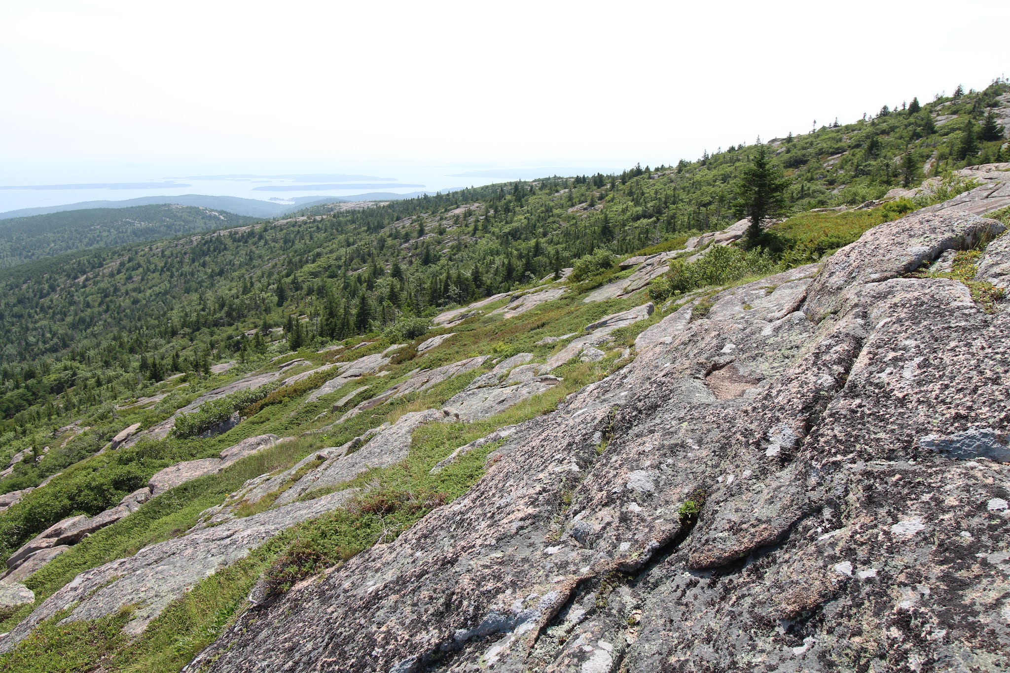
I (somehow?) was allowed to be in charge of planning our hiking excursions, but because I know not everyone’s idea of a good time is hiking all day, every day, we didn’t do anything too crazy. At least in my opinion. Our first hike was up Cadillac Mountain, at 1,528 ft the highest point on Mount Desert Island. Due to the increased crowds, you now have to reserve a parking pass to drive up Cadillac, but hiking doesn’t require a permit. Previously, we hiked Cadillac via the Gorge Trail (up) and the North Ridge Trail (down). We got caught in the rain and got views of nothing but clouds from the summit. This time, we were about to tackle Cadillac from the South Ridge Trail, which is longer but less steep.

We parked by the trailhead, I made everyone peanut butter and jam sandwiches, and we headed off on our adventure of the day. The first mile+ is wooded and (comparatively) gently sloping. For the next ~two miles, the trail is on rock surrounded by shrubs and small trees. First you follow a long ridge with lovely views on either side (the Atlantic Ocean to the right/east and further into the park on the left/west) and the summit ahead. That’s followed by a short descent down to a little pond called the Featherbed, then an ascent back up to another rock slope. The final half mile returns to the trees (what, you thought any of these little east coast peaks would get above treeline?) and roughly parallels the summit road close enough that you can both hear and see cars, which is a little annoying, but the earlier views more than made up for it.
 
Ascending Cadillac on the South Ridge Trail

The Featherbed

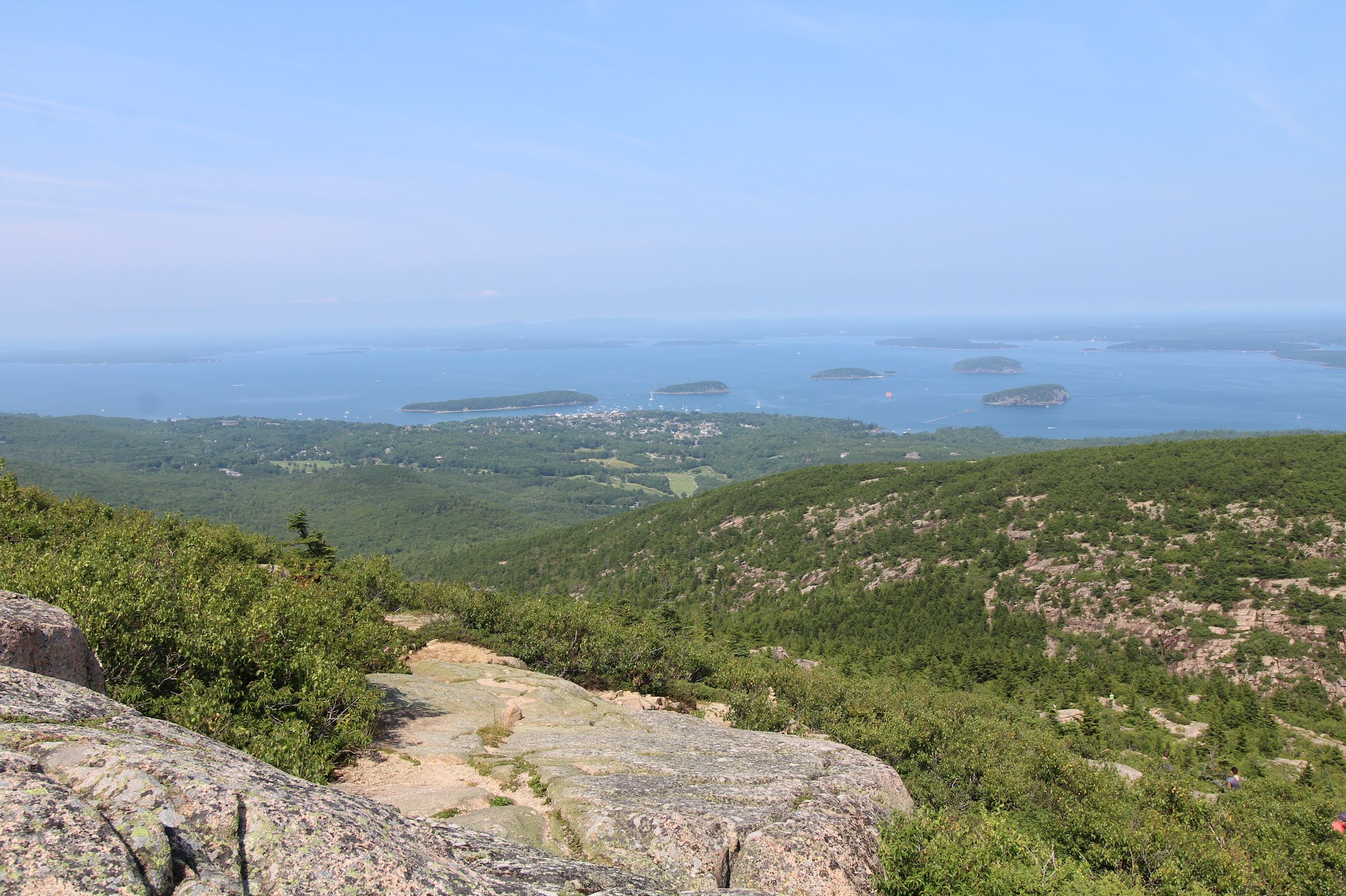
When we made it to the summit area, we found a spot to enjoy the view and lunch. As per usual, the vistas looked better and the meal tasted better because we hiked to get there.3 After eating, we walked around the summit to get the views of Champlain Mountain and Bar Harbor, then headed back down the mountain the same way we came up. At seven miles roundtrip, the South Ridge Trail is longer than your average casual “hey, let’s go for a hike” kind of hike, but the views really are quite delightful.

There were a couple sections that I would consider truly steep; other than those brief segments it’s mostly just a continuous climb with a little down and up around the Featherbed in the middle. We had pretty good weather, clear skies, a little hazy, not too hot, not too many bugs; the trail itself wasn’t too crowded (the summit was busy, and the store was pretty packed); and all in all it was a great start to our Acadia vacation.

Views from the summit

Bar Harbor, Bar Islands, and Champlain Mountain

Descent, looking out to the Atlantic

1Welcome to 2021, where Instagrammers is a word according to spell check and prefactor and rheometry aren’t. At least the opposite is true in the OED.

2Katahdin takes 8-12 hours to hike, is known for being rough on hiking boots (so just imagine what it would do to soft rubber shoes), and it’s recommended to bring half a gallon of water per person. Baxter State Park also requires every hiker to have a flashlight that’s not your phone and another of the items on their packing list is an emergency blanket in case you get stuck on the mountain overnight. So no, you don’t just waltz right up for that cool money shot on the Knife Edge.

3I’m pretty sure this is a proven scientific fact.
Thursday, September 9, 2021

On Walden Pond

So. I went home. In April, I received my first dose of Pfizer’s COVID-19 vaccine, and was considered to be fully immunized by the end of May. By June, there were less than 20,000 reported covid cases and 200-300 deaths per day in the US, over an order of magnitude lower than the January/February peak, so I booked plane tickets for the end of July. Of course, by August when I returned from my trip some states would be worse off than they were a year ago without the vaccine, but I appear to have escaped from my sojourns on public transportation mostly unscathed. With students still away for the summer, the Blue Bus I took to get between North and Central Campus and the Michigan Flyer from downtown to the airport were both uncrowded. My flights in either direction were fully booked, with mandatory masking that was mostly adhered to on the Michigan end and almost completely followed on the New England side.

After I arrived home, went to Wegmans, and spent several days lounging on the living room carpet, my brother also made his appearance and we started to take some family day trips, the first of which was to Walden Pond. Yes, that Walden Pond, where Henry David Thoreau went to live deliberately in the woods a whole two tenths of a mile from the road into Concord (to be fair, he directly tells the reader that in Walden, which I do own and had to read parts of during a class I took at Cornell). For two years, two months, and two days from 1845-1847, Thoreau lived in a cabin at Walden Pond on land owned by his friend and fellow transcendentalist Ralph Waldo Emerson. Today, the Walden Pond State Reservation is managed by the Massachusetts Department of Conservation and Recreation and features a beach area, hiking trails, and a replica of Thoreau’s cabin.

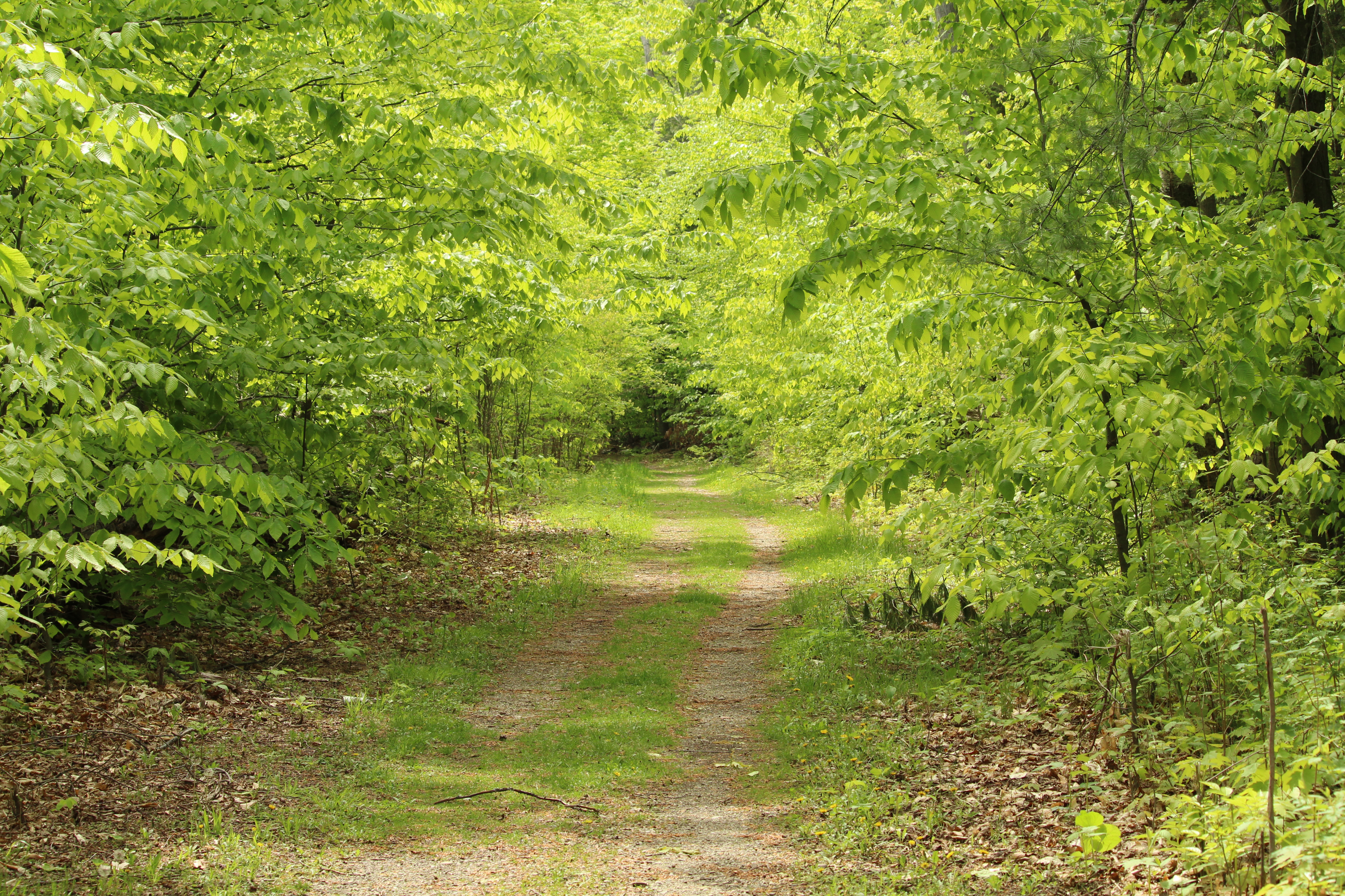
Walden Pond

When we arrived at Walden Pond, our first order of business, after parking, was a walk around the pond. The main path from the parking lot leads to the beach area, at the south end of the pond. From there, there’s an unpaved, but fairly flat trail around the pond that’s 1.7 miles long, part of which is a section of the Bay Circuit Trail that connects 37 towns in eastern Massachusetts. About 0.4-0.5 miles from the beach on the eastern side of Walden Pond there are signs leading to the site of Thoreau’s cabin (just the site; his actual cabin is gone and the replica is by the parking lot). Along the trail there are spots where you can access the lake shore, some with sandy areas where people were picnicking, reading, sunbathing, etc. During our circuit we encountered two or three dozen other people, so you were never very far from people but it also wasn’t crowded at all, and there weren’t any large groups blasting music and screaming, thankfully.

The site of Thoreau's cabin (cabin boundaries marked by the stone pillars on the right)

After circling the pond, we took a short walk up Emerson’s Cliff, elevation 289 feet, sadly possibly the highest hill I’d been on since before moving to Ann Arbor. From there, we got a view of nothing but trees (you might be able to see Walden Pond in winter), then descended to Heywood’s meadow, which was more marshy than meadowy. It did contain a beaver dam, and there was a potential beaver sighting, so that was a plus for the marsh meadow. By the time we returned to the parking lot, the visitor’s center was closed, so we went and concluded our visit with a stop by the replica of Thoreau’s one-room cabin. We visited on a summer weekday, and spent a little over 2 hours there. It was on the quiet side of busy, more so on the beach, less so on the trails, especially off the main pond trail. The only cost is parking, with in-state and out-of-state prices, and the parking lot can fill up on nice summer days and weekends, according to the website. Overall, recommended for anyone who wants to pair their hike and/or day at the beach with some history and vague memories of English class.

Replica of Thoreau's cabin

Friday, February 28, 2020

Home

When I finally made it home (we’re still back in December 2019), I had no plans except to go to Wegmans, bake a cake, and watch the latest Star Wars movie. It’s amazing how successful you can be at meeting your goals when you give yourself two weeks to go to a grocery store and watch a movie. Overall, my accomplishments for Christmas break included the following: 

– baking white chocolate/macadamia nut/Craisin cookies, cream puffs (choux pastry + crème patissiere), and a two-layer cake with whipped cream frosting and chocolate ganache all from scratch

– assembling two 1000-piece jigsaw puzzles

– using Netflix to watch Kim’s Convenience, The Irishman, The Two Popes, Mary Poppins Returns, and The Last Jedi, the last in anticipation of seeing The Rise of Skywalker at the movie theater [It was good. It’s a Star Wars movie, so be prepared for plenty of illogical decisions and departures from the laws of physics, but there are also lightsabers, spaceships, and lasers, which, let’s be honest, are the main highlights of a Star Wars movie.]

Clockwise from top left: cookies, slice of cake, cream puffs, top of cake

– getting dim sum. For all its self-proclaimed excellence, Ann Arbor doesn’t have many options for Chinese food, and none, as far as I’ve found, for dim sum.

– exploring Castle Island and Boston (Faneuil Hall/Quincy Market, the Common, Chinatown) [More on this in a separate post.]

– spending an abnormally warm Saturday afternoon raking leaves leftover from November

– spending a typically cold Tuesday morning (the day before I left) shoveling snow/slush off of the driveway. When I’m home, I shovel the straight part of our unnecessarily long driveway. I have a method, and it exercises both sides of the body equally.

Clockwise from top left: Clouds on the plane ride back to Ann Arbor, sunset over lake,
sunset at home, puzzle #1 (puzzle #2 was an underwater scene)

– going to Wegmans, where I admired their cheese selection and bakery

– ordering Christmas cards on New Year’s Eve. Christmas in January, anyone?

– not losing Monopoly to my brother’s girlfriend and her brother. Turns out if you actually follow the printed rules, the game doesn’t take twenty-seven days to play.

– not burning the church down at the Christmas Eve candlelight service

– watching Jeopardy!

– eating

– eating exactly one box of blueberry Chex

– sleeping

So that was Christmas break 2019.  It was great, and then I had to return to Ann Arbor to finish up another year of grad school. 

Wednesday, October 16, 2019

Road Tripping: The State of Ohio

Our last day on the road, we were headed west for Dayton, Ohio, then north back to my temporary home in Ann Arbor. My major accomplishment of the day was driving across the entire state of West Virginia. We stopped at the visitor center/rest area to switch seats and say we had physically set foot in the state, then I drove. If you’re familiar with US geography, you might know that West Virginia has a little spike that sticks up between Pennsylvania and Ohio. Yeah, that’s what I drove across. More hours in the car later, we pulled into Dayton. What’s in Dayton? you ask. The Wright brothers were from Dayton, and the Dayton Aviation Heritage National Historical Park is there, featuring exhibits, the Parachute Museum, one of their bicycle shops, and the Huffman Prairie Flying Field, with interpretive center.

We started at the interpretive center, where there was an exhibit about the Wright brothers and flight, covering their bike shop days, Kitty Hawk, and further experimentation at the Huffman Prairie. Because they no longer had the consistent winds of Kitty Hawk, they had to change from launching their flyers off a track to using a catapult. They spent two years improving their flying machine, then stopped flying altogether for two years to secure patents. After that, they travelled internationally, manufactured Wright Flyers, and trained pilots. Besides the exhibit, there was also one of those obviously educational videos with cheesy acting and blatant CGI/green screen. I thought it was great.

The next stop was the Huffman Prairie, the cow pasture where they tested their flyers. This is where things get interesting. The interpretive center and prairie aren’t in the same location, but they are both on the Wright-Patterson Air Force Base. Some parts of the base – including the parts where the interpretive center and prairie are located – are accessible to the public. Some parts are very much not. After some help from the friendly ranger in the interpretive center, we found the publicly-accessible gate and followed the signs to the Huffman Prairie. Mainly, it’s a big field, but they have a replica of the catapult and their flying shed/barn, plus a wildflower walk and a bunch of signs warning you against trespassing. It was a bit of an experience.

Flying shed at the Huffman Prairie

At that point, we still had time to go into Dayton itself to see the Wright brothers’ bike shop and the visitor center for the National Historical Park. Their bike shop in Dayton is similar to the one Henry Ford hauled up to Greenfield Village. At various times, their shop occupied six different locations – the one in Dayton is the only one still in Dayton; Ford took their last building to Michigan. Our last stop was the visitor center. There, we saw some of their printing equipment from when they had a print shop, and the Parachute Museum. Unrelated to the Wright brothers specifically, related more generally to aviation.

The Parachute Museum

On the way back to Ann Arbor, we took a detour back to Columbus to have dinner and see a friend. I know Columbus best as the home of the Columbus Crew, not The Ohio State University, if that tells you anything about how much I care about NCAA football and the Big Ten. We ended up having dinner down the street from the university, walked around a bit, then made the drive back to Ann Arbor. Two countries. Five states. Four days. Would I personally have planned it that way? No, it’s not my style. We’ve established that I can spend entire days in a single museum. But I saw some sights I wouldn’t have seen if I had planned the trip, and spent time with my friend, which was my main goal anyway. And so ended my summer 2019 travels.

Saturday, October 12, 2019

Road Tripping: Back in the USA

To circle Lake Erie in four days, we had to cover a significant amount of ground. Which is to say, we drove a lot on the last two days of our road trip. We drove out of Toronto in the morning, headed for Niagara Falls. Since we were already in Canada, we made a brief stop on the Canadian side of the falls. Having been to both sides, and having done some of the tourist activities on both sides, I will argue that I like the American side better. The Canadian side has a paved walkway with better views of the American and Horseshoe Falls, I’ll admit, but it gets worse as soon as you get away from that one area. Behind that street are casinos, hotels, souvenir shops, minigolf, Tussaud’s waxworks, Ripley’s Believe It or Not, a Ferris wheel. You know, everything you really need to truly enjoy the natural wonder of the waterfall with the highest flow rate in North America.

Top: American (L) and Horseshoe (R) Falls from the Canadian side
Bottom: American (L) and Horseshoe (R) Falls from the American side

We stayed long enough to take some pictures, then made the border crossing, which took approximately five minutes. On the American side, we stopped again to get the opposite point of view. This side isn’t completely noncommercial – there’s still the Maid of the Mist and Cave of the Winds – but it’s within a state park, which at least tempers the commercialism. The state park is recognized as the oldest in America, but has been majorly refurbished in the past 20 years. Being a state park, there are trails away from the falls where it’s much less crowded and much more nature-y. Again, we mainly remained long enough to take pictures before getting back in the car for one of our longer stretches of driving. We cut south through New York on some alleged highways through a bunch of villages, hamlets, and towns with no grocery stores, gas stations, or traffic lights to be seen. Although we were stuck inching down the state at 45 miles per hour, it was a lovely drive. There were these things called hills. Everyone from the west is laughing right now, but the Midwest is actually, seriously, flat. You don’t always realize it, because it’s not like there are zero elevation changes across the entirely of the middle of America, but you’re rarely surrounded by hills. This brings my list of things I miss about New England to Wegmans, the northeast accent, actual snow, and hills.

View from Rimrock Overlook

Our destination for the day was Pittsburgh, but we made one more stop on the way. We stopped, again very briefly, in the Allegheny National Forest in Pennsylvania. Confusing fun fact of the day: the Allegany State Park in New York (just across the border) spells Allegheny without the h and with an a. I probably could have spent days walking around in there, but we didn’t have days, we had an hour, so we drove up to the Rimrock Overlook, and I hiked down a bit before hiking back up. It was almost quiet on the trail, if it hadn’t been for motorboats on the lake in the distance. But it was still a lovely walk, with plenty of trees, dirt, rocks, steps, and it was even slightly muddy.

On the trail

And I also miss hiking trails that look like this

When I returned to the car, we drove the last few hours to Pittsburgh. We got upgraded to a suite at the hotel, which has never happened to me in my life before. I guess this is what happens when you book using a business account instead of discount hotels R us dot com. I had dinner at IHOP because it was nearby and also I get hungry for breakfast for dinner once in a while. Back at the hotel, I settled into my personal bedroom to watch American Ninja Warrior and poker. Because no matter where you go, the hotel TV is always showing American Ninja Warrior and poker.