Showing posts with label outdoors. Show all posts

Saturday, October 22, 2022

Parker River National Wildlife Refuge

To close out astronomical summer in the northern hemisphere, we paid a visit to the Parker River National Wildlife Refuge on Plum Island, off the northeast coast of Massachusetts. The island is named for the beach plum shrubs that grow on its dunes, and the wildlife refuge is managed by the U.S. Fish and Wildlife Service. Entry costs $5 for a day pass for a car, or it’s free if you have a national parks pass. Parker River is popular with birdwatchers, and it contains a number of beach access points, lookouts, and trails throughout the island. There are also a couple of canoe routes that allow you to get up close and personal with the marshes, but we didn’t explore any of that this time.

You enter the wildlife refuge at the north end of Plum Island, and the road runs roughly north to south up and down the island. Along the road, there are seven numbered parking lots and several other pullouts for lesser attractions. We started at the first, and northernmost, parking lot, which serves as one of the main access points for the beach. The beach was quiet, though not deserted, with a few dozen people spread out across the sand. A couple people were braving the water, but most were walking along the beach, fishing, picnicking, or just enjoying the sun. We walked a ways down the beach, hung out with seagulls, and examined dead crabs before finding a spot in the sand for our peanut butter and jam sandwich and banana lunch.

Ring-billed gull

After lunch, we returned to the parking lot and started making our way down through the rest of the refuge. We stopped briefly at the Salt Pannes Wildlife Observation Area and the North Pool Overlook, a pullout on the road and a small parking lot respectively. At the salt pannes, we saw a wildlife, a lone swan with the tip of its beak submerged (likely a mute swan but it could theoretically have been a trumpeter), and at the North Pool was a family of mute swans, two adults and four juveniles that were adult-sized but still brown-feathered. Our next big stop was at the Hellcat Wildlife Observation Area (parking lot 4), which features a boardwalk trail and observation tower.

A short distance from the parking lot, you can turn off the boardwalk and cross a dike to reach the observation tower, which overlooks the North Pool to the north, the Bill Forward Pool to the south, and salt marshes to the west. Here we found the largest concentration of bird photographers, fully equipped with cameras, tripods, and telephoto lenses larger than my arm. I had my, relatively speaking, compact 55-250mm lens with me, which on a crop sensor camera is at the bottom end of the range you need to get started birding. I did still manage to capture a bunch of mallards, some yellowlegs, mute swans, a great blue heron, and an unidentified duck-ish bird. Back on the boardwalk, we made a loop through the forest, with trail spurs that led to views of the ocean and marsh. Including all the spurs, the trail is about 1.3 miles, plus another ~1000 feet out and back to the observation tower.

Across the marshes

View from the Hellcat observation tower - North Pool

Shortly after the Hellcat parking lot, the refuge road stops being paved, which ranges from “slightly annoying” to “I hope my engine doesn’t fall out.” It seemed worse going south than north, but we and the car survived. We made stops to hike the Pines and Stage Island Trails (slightly before parking lot 5 and parking lot 6). The Pines Trail is a quick 0.3 miles in the woods with a marsh overlook. The Stage Island Trail is 0.7 miles one way to the Ipswich Bluffs. Along the way, you see marshes, a couple pools, and across the Plum Island Sound to Great Neck. I found a group of yellowlegs at one of the pools, but unfortunately I wasn’t carrying a ruler to determine whether they were 10 or 14 inches tall, so I’m not sure if they’re greater or lesser yellowlegs (or a mixed group).

Yellowlegs

Our final stop was at the last parking lot before Sandy Point State Reservation, a Massachusetts state park. There was another observation tower looking out across an expanse of waving reeds/grass and beach access, which we used to get one last look at the ocean before heading home. I also got my last bird photos of the day, of a sandpiper of some kind. My best guess is a semipalmated sandpiper. We ended up spending a little over 5 hours at Parker River, which included lunch, some time on the beach, and all of the main hikes, but not playing on the beach/in the ocean or extended birdwatching stops, so depending on who you’re with and your interests, your timing and choices of activities may vary.

Field of grass

(Possible) semipalmated sandpiper

Sunday, July 17, 2022

Cuyahoga Valley National Park

On our long drive back east, we passed right by Cuyahoga Valley National Park in Ohio, so we had to make a quick stop for a hike. The Cuyahoga Valley is located between Cleveland and Akron and the Cuyahoga River is famous for, among other things, catching on fire. This happened at least 13 times, and the June 22, 1969 fire helped to bolster the beginnings of the American environmental movement. In 1974, the Cuyahoga Valley was designated a National Recreation Area, then on October 11, 2000, was made a national park.

Boston Mill Visitor Center

We didn’t have much time at Cuyahoga, and the one hike that you do if you only have time for one hike at Cuyahoga is the Ledges Trail, which is what we did. If the parking lot at Brandywine Falls wasn’t closed, we might have also tried to sneak in a glance at a waterfall, but that wasn’t in the cards for this visit. The Ledges Trail is a 1.8 mile loop that circles a plateau of rock formations. The trail network around the Ledges Trail also includes several cut-through trails and side trails that connect to other areas of the park. The trail is primarily dirt and rock, with rock steps in several places. Along the way, you walk at the bottom of and between rock cliffs that are fun to explore but difficult to fully capture in photos.

Ledges Trail

The trail passes by a cave, but to protect the bats there from white-nose syndrome, caused by the white fungus Pseudogymnoascus destructans that can decimate bat populations, the entrance was barred. There’s also an overlook, the Ledges Overlook, that didn’t seem to be overlooking anything of much significance. Especially in late spring and summer with the trees filled with leaves, you mostly just see a lot of trees with leaves. The rest of the trail makes up for It, however. And as we were nearing the end of the trail, we spotted a barred owl, out in the evening, our first time seeing an owl in the wild.

Barred owl

Cuyahoga Valley National Park is slightly unusual in that it can almost be described as an urban national park, with 4 million people living within a half hour drive of the park. Parts of the park either abut and/or are managed by Cleveland Metroparks, Summit Metro Parks, or private owners. Besides the ledges, it contains waterfalls, wetlands, ravines, forests, and more. The Cuyahoga Valley Scenic Railroad goes through the park and offers scenic railroad rides throughout the year. There is no fee to enter the park, though we still made a quick stop at the Boston Visitor Center to talk to the park ranger, and pick up a map and stamp. There’s plenty we didn’t get to see in the park, so we might be back if we’re ever in the area, though I also still have about 400 (of 423) National Park Sites and hundreds and thousands of state and local parks to visit.

Saturday, June 25, 2022

Sleeping Bear Dunes, part 2

For the second half of the trip, I had a couple more hikes planned. In the morning, after another round of sandwich making, we headed out for Alligator Hill. Alligator Hill has a total of nine miles of trails divided into three loops. We took the shortest loop to the Islands Lookout and back with a detour along the spur to the Big Glen Lookout, for a total of 4.3 miles, our longest single hike of the trip. The internet told me that Alligator Hill was a fun hike with great views of Lake Michigan and Glen Lake, but especially after the previous day the views were good but not amazing.

On the trail at Alligator Hill

The dirt trail is mostly wooded, and Alligator Hill is indeed a hill, so there is some ascending/descending, but nothing overly strenuous. After 1.3 miles, you reach the Islands Lookout which does give nice views of Lake Michigan, including North and South Manitou Island. While we were stopped to snack on bananas and take photos, we saw a bald eagle in the wild for the first time, and I did get a not entirely in focus picture with my telephoto lens. Shortly after that point, we turned off the main trail to the Big Glen Lookout. It was a 1.6 mile detour, and when we got to the clearing in the trees I’m not sure I can say it was really worth it. About all I can say about it is that it was a view of a lake.

View from the Islands Lookout

Back at the parking lot after a couple hours+, we piled back into the car and drove to the Dunes Trail to have lunch at the picnic area there. From there, we continued on to the last hike I had planned, Pyramid Point. Pyramid Point is another short trail that leads to a view of Lake Michigan. There’s a 2.7 mile loop, but we just did the 0.6 miles (one way) to the lookout and back. At the lookout, we had more large bird sightings – a small group of turkey vultures and a likely red-tailed hawk (the red tail was not visible in the photo I got). We took about an hour to hike up to the lookout, enjoy the lake from the top of the bluff, and hike down from the lookout.

View from Pyramid Point

At that point, it was midafternoon, and we’d completed all the hikes I had planned for us, so we drove around for a bit, stopped in Glen Haven (a former company town where you can still see the general store, cannery-turned-boathouse-museum, and blacksmith shop), then returned to the Airbnb early. After dinner, we walked to the beach for a Lake Michigan sunset, then closed out the night by watching Shrek Forever After.

From left to right: bald eagle, turkey vultures, red-tailed hawk

Sunset over Lake Michigan

We probably could have fit more into the trip, but we saw most of the main attractions, except maybe really getting to enjoy the beach and I’ve heard the Maritime Museum is interesting. It felt cooler than my Upper Peninsula trip back in October, but it didn’t rain. I’m really not a huge food/shopping person, so I didn’t mind the tradeoff of closed stores for no crowds. I shot the whole trip on my T6 with an ultrawide (10-18mm) and a telephoto (55-250mm) lens, and I think it works well for hiking trips, possibly not as good if we had been indoors more/at all. Overall, it was a good trip.

Tuesday, June 21, 2022

Sleeping Bear Dunes, part 1

Before leaving Ann Arbor, we took a quick family vacation to the west side of Michigan to see the Sleeping Bear Dunes, another one of the things you should probably see if you lived in Michigan for six years. Like Pictured Rocks, Sleeping Bear is National Lakeshore managed by the U.S. National Park Service; a weeklong pass for a private vehicle costs $25. We spent two full days at Sleeping Bear, and did four of the hikes in the Lakeshore, which covered most of the highlights of the area – climbing the dunes, spending some time on a Lake Michigan beach, and getting various views of the lake and dunes.

Our first day was primarily a travel day – we left Ann Arbor bright and more or less early, picked up my brother and his girlfriend in Kalamazoo, and arrived in Glen Arbor midafternoon after a stop for a lunch of pasties1 (another Michigan thing to try before leaving), an apple dumpling, and apple blueberry pie. The Airbnb we stayed at in Glen Arbor was nice, even if I was literally sleeping behind the closets of both actual bedrooms. After checking in and unpacking a little, we went out to explore Glen Arbor, walked to the beach, and had dinner at Cherry Republic.
 
Dunes Trail with Lake Michigan in the distance

The next morning, we set out on our second longest but most challenging and probably also most iconic hike, the 3.5 mile (round trip) Dunes Trail up the Dune Climb to Lake Michigan. We were at Sleeping Bear the weekend before Memorial Day, before the official tourist season started. Some amenities and restaurants were still closed for the winter, but enough was open that it was worth not dealing with crowds anywhere. The weather was cool (highs close to 289 K2) but clear throughout the entire trip, so shorts and jacket weather, plus extra jacket + glove-mittens for the wind off of Lake Michigan. There were about three cars in the parking lot when we got to the Dune Climb, and we eventually encountered a half dozen or so groups of people on our way to the lake.

The initial climb is the longest sustained incline, but you do have to climb and descend four more dunes on the way to Lake Michigan. The sand is indeed coarse, rough, and everywhere, but wasn’t too irritating. The entire route is on sand, though you pass through areas with dune grass, flowers, and small trees, and though the way is mostly straightforward, it’s marked with blue-tipped poles to steer people away from alligators areas where they’re trying to prevent erosion. At a fairly leisurely pace and stopping a lot to take photos, it took us about eighty minutes each way. We had lunch, part 1, when we got to Lake Michigan, where it was windy and cold, so we didn’t explore the water much. Back at the parking lot, we had lunch part 2, featuring more of my favorite vacation anytime food, peanut butter and jam sandwiches.

At Lake Michigan at the end of the Dunes Trail

After lunch, we stopped by the main visitor center, the Philip A. Hart Visitor Center, to pick up a park pass, map, and stamp, then continued on to our second hike of the day, the Empire Bluff Trail. The internet told me this was one of the most popular trails, so I guess we had to do it. It’s a relative quick 1.5 mile hike that goes through forest before coming out on a boardwalk that boasts views of Lake Michigan and the lakeshore. It was nice, worth doing, and only takes about an hour of your time.

View from Empire Bluff Trail

Finally, we drove the Pierce Stocking Scenic Drive, a 7.4-mile loop with a dozen stops where you can get out for photos, though a few of the stops appeared to have views of nothing but trees. When we were there, I believe the drive had just opened for the summer (it’s closed in the winter). You are allowed to bike it, though the NPS website advises only expert cyclists to attempt it. The overlooks, complete with informational signs, provide views of Lake Michigan, the dunes, and the Glen Lakes, and there are also some hikes and picnic areas that are accessed from the drive. We spent about an hour and a half driving, stopping, getting out of the car, enjoying the views, getting back in the car, etc. before heading back to our Airbnb for the night. All in all, it was a successful first day of our trip.

At the Lake Michigan Overlook on Pierce Stocking Drive

1A pasty is a hand pie filled with meat and root vegetables (potatoes, rutabaga, etc.) brought to Michigan from Cornwall.

260 F/16 C

Tuesday, April 19, 2022

Winter

After returning from the Upper Peninsula, as I mentioned in my yearly post, I jumped into speed writing my thesis before defending right before Christmas, then final thesis revisions were due in January. In between all that, I generally carried on as usual with life in Ann Arbor. It wasn’t a particularly cold or snowy winter, so I got outside when I could, including biking through the winter months. Right after Thanksgiving, I got my telephoto zoom lens, so I also spent time crawling through the undergrowth looking for squirrels and birds.

Squirrel

Early in December, I paid a visit to the arboretum to try out my telephoto lens. Around that same time, the public golf courses run by Ann Arbor Parks and Rec open up to walkers/dog walkers/etc. by inverse rule – from March to November, non-golfers are explicitly not allowed to be on the golf course, but if it’s not March to November, they’re not not allowed. I’ve mostly been walking in the same circles for the past two and a half years, so the golf course is a nice variation and it gives the golf course purpose in the winter.

Golf course cloud at sunset

I also continued on my other usual paths. The ornaments were out again this year in one of the parks I frequent, and I found some new additions. The week before Christmas, Ann Arbor got freezing rain, and I made a loop around my neighborhood to get photos. Between Christmas and New Year’s, a coworker and I made a trip to the botanical garden when the weather was too nice to stay inside. The indoor conservatory had reopened by then, and had a couple Christmas trees plus an “art” exhibit where they put frames around some of their plants to highlight different design principles used in art like color, space, texture, etc.

Some sort of Christmas rodent

Christmas tree at the botanical garden conservatory

With my bike in action and a telephoto lens in hand, I headed to the Huron River a couple times in January because from prior years I knew that a lot of ducks/geese/swans gather along the shores of the Huron during winter. It was mostly mallards and Canada geese, but also some trumpeter swans and once I saw a pair of hooded mergansers. With the weather holding through January, I biked my new telephoto lens out to the Barton Nature Area as well, but arrived in time for the sun to be setting directly over the river, so didn’t get a whole lot with it.

Barton Dam

February finally stayed cold enough any snow we got to stick around for a while. One day, we were getting a good amount of soft, fluffy snow, the kind that sticks to branches if there’s not too much wind, so after work I headed out with my camera. Mid-February, there was one warm day that I took my bike out on the Border to Border trail. The B2B, at least the sections that go through the major parks, does get snow removal services during the winter, so that was clear. Once I got to the Parker Mill Park section, it was slushy, but passable with my all-purpose Target children’s bicycle. Then I got a look at the Matthaei Botanical Gardens Trail, and somewhere in the back of my mind I think I did remember it falls into the university’s “no winter maintenance” category. The MBGT was essentially melted water over hard packed snow/ice, in other words, very slippery. At that point I decided it was not a good day to die, so I turned back there.

Snow on trees

Monday, February 28, 2022

Copper Harbor & Mackinaw City

On our final full day up north, we had plans to travel to the northern tip of the Upper Peninsula before crossing back over the Mackinac Bridge to the Lower Peninsula to spend the night in Mackinaw City. In the morning, we decamped, cleaning up the cabin and repacking the car before heading on our way. We drove up to Copper Harbor to see the Copper Harbor Lighthouse and the Devil’s Washtub. Unfortunately, the land that the Copper Harbor light is on had been sold to a private owner and could only be viewed from across a bay and I’m not sure if we ever found the Devil’s Washtub. However, after planning our activities for the first three days of the trip, I was not responsible for this leg’s itinerary, and what we did end up doing was still good.

Baraga State Park mini cabin

With the lighthouse under private management, the main way to see it is now from Astor Shipwreck Park. This park is across the street from Fort Wilkins State Park, which we didn’t have time to check out on this trip. There’s a small parking lot and a few steps down to a rock beach with a view of the Copper Harbor light. We spent some time on the beach, where we enjoyed the sun and bright blue skies for the first time on our trip, and ended up having an early lunch by the beach.

Copper Harbor Lighthouse

Clockwise from top left: Astor Shipwreck Park, rock beach at Astor Shipwreck Park, Eagle River Timber Arch Bridge, shore of Lake Superior near the Devil's Washtub

On the way back from Copper Harbor, we stopped right on Route 26 to try and find the Devil’s Washtub, a rock inlet on the coast of Lake Superior that’s supposed to be bathtub shaped, I guess? We walked along the coast for a bit and found something that looked vaguely bathtub-esque, but I’m not convinced we found it. But the sun and views and rock scrambling were nice.

Continuing on our way back, we paid a visit to the Eagle River Timber Arch Bridge, from where we also saw the Eagle River Falls. Across the street the Eagle River Museum was closed, but there was what appeared to be a public park next to it with sports fields, playground equipment, a garden, and a pavilion. When we saw that they had a merry go round, we had no choice but to try it out, because how often do you see a merry go round nowadays?

Eagle River Falls

From there, we finished the long drive across the Upper Peninsula to Mackinaw City. After some hotel drama, we managed to check into our room. Before bedding down for the night, we went out for one final adventure of the day to stargaze at the Headlands International Dark Sky Park just outside of the city. When we arrived, the parking lot was busy (and we could already clearly see the big dipper), but as we set out on the paths, we hardly encountered any people. We found an empty beach to admire the sights from and looked up.

Tripod-less astrophotography (the handle of the Big Dipper is the bright stars in the lower right of the sky)

The moon was blazing bright, close to full if not full, so we didn’t see as many stars as we could have, but at least the sky was clear, and there were more stars than I’ve seen for awhile. With the help of an app (of course there’s an app), we identified several constellations. I also tried out some tripod-less astrophotography that pushed the limits of my hobbyist camera and only ended up a little blurry.

In the morning, we collected our sad Covid hotel breakfasts consisting solely of bottled water, an apple, and a single granola bar; checked out of the hotel; and drove to the Mackinac Bridge to enjoy breakfast in sight of Mighty Mac. From there, all that was left was the drive back to Ann Arbor. All in all, it was a great trip. I’m glad I got to see some of the Upper Peninsula before graduating and likely moving away from Michigan, and after a year and a half away from the office, getting to spend time with my labmates.

Sunrise over Lake Huron

Mackinaw Bridge

Thursday, February 24, 2022

Porcupine Mountains Wilderness State Park

Day three dawned grey. Again. But it was not raining. Following a cold breakfast featuring shelf-stable ultra-pasteurized milk and granola bars, we drove the final hour to the Porcupine Mountains Wilderness State Park. This park is managed by the Michigan Department of Natural Resources, so requires a Michigan Recreation Passport, $17 for the year for instate vehicles if you buy one at a park entrance but less ($12) if you get it when you renew your license plates.

I planned for one not-too-long hike by the Lake of the Clouds, the one place everyone goes if you go to the Porcupines. When I asked my coworkers, they all said they’d be okay with some hiking, but I am aware that most people don’t casually go for three mile romps through the woods in all kinds of weather on an average evening, possibly after a full day of work. The internet told me that the Escarpment Trail, leading away from the Lake of the Clouds, had some of the best views in the park, and if we hiked it as an out and back, we could choose how long we wanted our hike to be.

When we arrived, it was foggy/misty/cloudy (again) with clouds rolling across the landscape. We went first to the Lake of the Clouds Overlook where we got our first look at the lake and surrounding mountains. Although it was supposed to be late in the season for fall colors, there were still a lot of yellow and even green leaves on the trees and the view, when not covered with clouds, was lovely. The overlook is located at the west end of the lake, facing east down the length of the lake with mountains sloping upwards from the north and south shores.
 
Clockwise from top left: Lake of the Clouds upon arrival, Lake of the Clouds partway along the Escarpment Trail, the Escarpment Trail, close up of trees

From the overlook, we found the Escarpment Trail that leads east along a ridge on the north side of the Lake of the Clouds. As I’ve mentioned already, it was pretty quiet because we were there past what’s considered peak timing for the fall season, and it got even quieter on the trail away from the overlook. At times the trail winds through trees, at others it comes out onto rocky ridges with spectacular views of the lake and surroundings. Would highly recommend this trail.

Upper Carp River east of Lake of the Clouds

Clockwise from top left: View from our lunch spot, Upper Carp River, Lake of the Clouds post hike, view looking west from the Lake of the Clouds overlook

We ended up hiking somewhere over two miles down the trail past the eastern end of the lake and a little ways up the Upper Carp River. We stopped for a snack/lunch break right by the eastern end of the lake where we could enjoy the sights. As we hiked out, the weather cleared up a fair bit, but as we started on our way back to the parking lot, the clouds began to thicken yet again. At one point I think we walked through a cloud, but any rain held off.
 
Big Carp River (from the Lake of the Clouds overlook)

From the Lake of the Clouds, we moved to the Summit Peak Scenic Area for a different view of the park. The trail here was 0.9 miles one way to the top of Summit Peak, the highest point of the park. The lower half is a nice walk through the woods that transitions into a wooden boardwalk and steps ending at a 50-foot observation tower. The views weren’t amazing, but it was worth a quick look and now we can say we’ve been to the park’s highest point.
 
View from Summit Peak

Observation Tower

Like the previous day, because of our limited time in the area, I opted for visiting a few places for a shorter amount of time rather than spend more time in one or two spots in order to get more of an overview of the park. That said, our last stop of the day was the Presque Isle Scenic Area to see waterfalls. This hike reminded me of some hikes through the gorges in New York’s Finger Lakes region. The trail wound through a gorge right off of Lake Superior with several waterfalls, smaller than the ones we saw the day before, and was a nice end to our day in the Porcupines. I think this area was where we encountered the most people in the day, but still nothing compared to some of the summer crowds I’ve seen.

Presque Isle Scenic Area

We made the drive back to Baraga State Park, where we prepared another camp dinner (oatmeal and a banana for me) before enjoying a second night in the mini cabin. It was definitely cool at night, but the cabin with four people in it never even got cold enough for me to put on pants. (I wore shorts for the entirety of the trip.) There was a space heater provided, and at one point we turned it on to see if it worked, but we didn’t need it. The shared bathroom block was nice, and there were individual shower stalls, with nice hot water, at the back of the building. Overall, even with the traffic noise, $52 a night split between four people was well worth it for a fun experience that requires less vital equipment than tent camping.

Saturday, February 19, 2022

Pictured Rocks National Lakeshore [part 2]

Barring the combination farewell present of possible heatstroke and/or getting hit by lightning that Cornell gave us at my graduation, most of my travels have not been strongly adversely affected by the weather. We had a couple marginal days at Acadia, and I have all sorts of transit stories, but overall it’s been awhile since we’ve gotten caught in a full on downpour in the middle of an outdoor activity. The forecast for our U.P. trip wasn’t great, and that combined with a fairly tight schedule and companions who probably didn’t want to trek 10 miles through the woods, led me to pick a few shorter/less involved sights to see at Pictured Rocks.

After hotel breakfast, we set out to our first destination, Miners Falls, a 1.2 mile round trip from a parking lot near the east end of the park. It was damp, misty, and a little drizzly when we set out on the short hike, but overall conditions weren’t too bad. There were a few cars in the lot when we arrived, and more arrived later, but because we were there late in the season, it was pretty quiet. The trail to the falls is more or less flat is it winds through the woods and leads first to an overlook by the top of Miners Falls where you can see the falls but they’re somewhat impeded by trees. There’s a second viewing area further down several flights of stairs with clear sightlines to the falls. Miners Falls is about 50 feet high, so not super tall, but a nice waterfall with a good amount of water falling down it. Including the walk to and from the falls, taking photos of the falls and misty trees, and discovering and observing various slugs, we spent about an hour at Miners Falls before heading further down the road to Miners Castle.

Miners Falls

Slugs, misty trees, and lichen

Miners Castle isn’t a castle building but a rock formation that looks kind of like a castle turret, I guess. There are also two viewing areas for Miners Castle, one off of the parking lot where you look over the lake at the cliffs and the whole rock formation, and one a short walk down some steps where you get to see the turret up close. This was a quick stop, just about half an hour for some photos as the mist rolled in.

Miners Castle

Our last destination in this area of the park was Miners Beach, where you can get some views of the cliffs from the shore. By this time, it had started to rain more heavily, and the mist thickened, but we still spent about forty five minutes wandering up and down the beach enjoying the wet sand and lake.

Miners Beach

Also Miners Beach

Before leaving Pictured Rocks to head further west, we stopped for lunch sandwiches (that I made at the hotel before checking out) in the Munising Falls parking lot. We then made the short walk, all paved, to Munising Falls. The 50-foot falls are located in a sandstone cliff U of a canyon. The rain had let up a bit by this point so we were a little less wet as we explored the area around the falls.

Munising Falls

Between the cruise the previous day and our stops on day two, I think we got to experience most of the big attractions at Pictured Rocks. There are plenty of other sights we didn’t get to see across the 42-mile lakeshore but we hit up some of the major locations with our limited time. Entry to the park was free when we went, but with increasing numbers of visitors and their accompanying environmental impact, Pictured Rocks, managed by the National Park Service, is soon to start charging entrance fees.

Our lodgings for the night was the mini cabin at Baraga State Park, and on the way we made a stop at Laughing Whitefish Falls State Park for one last waterfall for the day. Still slightly damp from the morning, we took another short half-mile hike through the trees to the falls. Finally, we finished the drive to Baraga State Park, about an hour east of Porcupine Mountains Wilderness State Park, and got settled into their mini cabin. When we booked the cabin, I didn’t realize the park was right off of Route 41, with its accompanying traffic noise, which was the main negative comment people had, but it didn’t end up being too bad with the windows and door closed.

Laughing Whitefish Falls

A couple of my coworkers had never been camping in any form, and it being the middle of October 4 degrees further north from my usual environs, the camper cabin was a better decision than tent camping, which we very briefly considered. But without much equipment and night temperatures starting to drop towards freezing, we would not have had as good of a trip. The cabin was pretty small, maybe 12 feet square, and had some counter space, a microwave, a mini fridge, a queen bed with a twin lofted over it, and a cot. I slept on the cot (in my sleeping bag). After unpacking bedding and food, we prepared a ramen dinner, then settled in for the night.

Saturday, February 12, 2022

Pictured Rocks National Lakeshore [part 1]

It took until I was about to graduate, but I finally made it up to Michigan’s Upper Peninsula (U.P.) back in October. By the beginning of the school year, my coworkers and I had started to return to the office more frequently (because of staggered schedules and a small group size, our office was operating between low and no density, and that plus vaccines and no huge delta spike meant that people were feeling pretty okay about being there).  One day they got to talking about taking a trip up north to see the fall colors, and I got roped into the conversation and soon found myself agreeing to head for the Upper Peninsula with half the lab.

We left on a Monday morning and arrived at Pictured Rocks National Lakeshore in time for a late afternoon boat tour. The next day, we spent the morning and early afternoon at Pictured Rocks before driving further west to our lodgings at a state park about an hour away from the Porcupine Mountains Wilderness State Park. On Wednesday, we hiked around the Porcupine Mountains, then on Thursday drove up to Copper Harbor before heading back across the U.P. to spend the night in Mackinaw City. On Friday morning, we made our way down to the palm, arriving in Ann Arbor by early afternoon.

For reasons, I ended up planning the majority of our activities with input from my coworkers, similarly to my Acadia trip in the summer. The first day, we agreed to get on the road early so we could arrive at Pictured Rocks by early afternoon with time for a cruise. Everyone held up their end of the deal, pickups started at 7 am, and we were heading north out of Ann Arbor by 8. We stopped at a gas/service station for a brief lunch before continuing on our drive. It was six hours to the Grand Sable entrance at the east end of Pictured Rocks, then another hour through the park to Munising, where the cruise would leave from. We were there at the tail end of fall colors, but the drive through the park was lovely and there was a mix of trees with green, changed, and fallen leaves.

The cruise was scheduled to begin at 4 pm, and even though we arrived about half an hour early, there were already a number of people lined up for boarding. I’m not a huge fan of cruises and other touristy guided tour type activities, but my labmates wanted to go and there are some landmarks that can only be seen from the water so we did it. The company was Pictured Rocks Cruises, and we were actually there during their second to last week of operation for the season. We took the classic cruise that ran for about two and a half hours and cost $40. The boats have two decks, with the top deck open and the right side of the top deck most desirable for photography reasons. We ended up on the left side of the top deck, which worked out fine because on the way back that’s the side that’s closer to the Pictured Rocks’ namesake rocks.
 
East Channel Lighthouse

Miners Castle

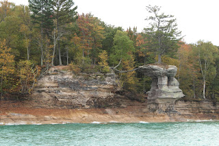
The cruise passes by the East Channel Lighthouse, Miners Castle, the Caves of All Colors and Rainbow Cave, the arches Lovers Leap and Grand Portal, Battleship Row, a Flower Vase, and Chapel Rock, among other things. On the way out, a guide described what we were passing by and gave some historical and scientific facts about the rocks. The colors come from minerals leaching out of the rocks – orange and red come from iron, blue and green from copper, brown and black from manganese, and white from limonite.

Lovers Leap

Battleship Row

It was coolish at the beginning of the cruise, then got windy as we got out on the water and a little cold as the sun started setting. Would definitely recommend a jacket (which I had), especially late in the season and the day. The light was somewhat challenging, with the overcast sky being bland while also both blocking ambient light and being bright enough to blow out. I had my camera with both my wide angle 10-18 mm lens and the 18-55 mm kit lens (roughly equivalent to 16-28.8 mm and 28.8-88 mm in the “standard” full frame/35 mm format). The wide angle was generally too wide for how far we were from the rocks and I ended up needing the zoom from the kit lens most of the time. Also, we were continuously moving, it was cold, and I was shooting over and between people for most of the trip. Anyway, if you don’t find the price too steep, don’t really like hiking and/or don’t have much time, the cruise is a good way to see a lot of the big attractions at Pictured Rocks, and you often get better views than you would from land.

Chapel Rock

Rocks and trees

After we docked, we had dinner up the street from the cruise headquarters, then drove back toward the park to spend the night at a hotel, which ended up being the most expensive lodgings for our trip. In the morning, we enjoyed our hotel breakfast before heading into the park to explore a bit on foot.