Before it became trendy for the Instagrammers
1 and hipsters and bandwagon outdoorspeople to pack up their iPhones, $300 backpacks, and brand new hiking boots and take to the hills and dales, my family was enjoying hiking and camping because it was cheap. And fun. I’m absolutely not judging who is or isn’t a “true” hiker, but do it because you like it, not because you want social media clout or because everyone else is doing it. And please,
please, do some research and don’t do something like show up to climb Katahdin at 2 pm wearing crocs and carrying a single 8 oz. bottle of water that belongs in an elementary schooler’s lunch box.
2 With that said, on to the actual subject of this post.
Part of my trip home was a family vacation to Acadia National Park, in Maine. Acadia is the only national park in the northeast, and even the last time we were there in 2013, the park rangers were already saying that attendance was rapidly increasing. Thanks to social media, covid, and probably some other factors, when we were there this time, it was downright crowded (in certain areas; others weren’t too bad). Still, we had a good trip, and I think I’m happy with my new wide angle lens.
I (somehow?) was allowed to be in charge of planning our hiking excursions, but because I know not everyone’s idea of a good time is hiking all day, every day, we didn’t do anything too crazy. At least in my opinion. Our first hike was up Cadillac Mountain, at 1,528 ft the highest point on Mount Desert Island. Due to the increased crowds, you now have to reserve a parking pass to drive up Cadillac, but hiking doesn’t require a permit.
Previously, we hiked Cadillac via the Gorge Trail (up) and the North Ridge Trail (down). We got caught in the rain and got views of nothing but clouds from the summit. This time, we were about to tackle Cadillac from the South Ridge Trail, which is longer but less steep.
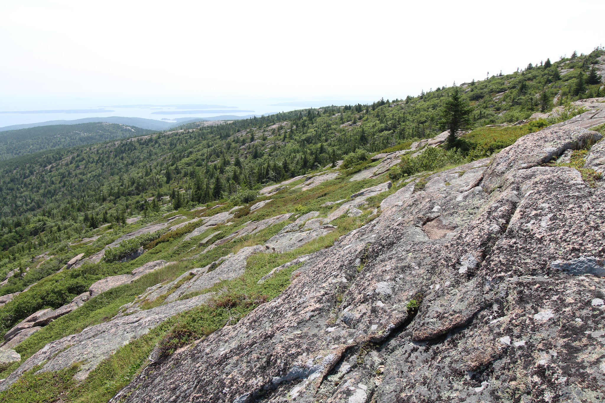
We parked by the trailhead, I made everyone peanut butter and jam sandwiches, and we headed off on our adventure of the day. The first mile+ is wooded and (comparatively) gently sloping. For the next ~two miles, the trail is on rock surrounded by shrubs and small trees. First you follow a long ridge with lovely views on either side (the Atlantic Ocean to the right/east and further into the park on the left/west) and the summit ahead. That’s followed by a short descent down to a little pond called the Featherbed, then an ascent back up to another rock slope. The final half mile returns to the trees (what, you thought any of these little east coast peaks would get above treeline?) and roughly parallels the summit road close enough that you can both hear and see cars, which is a little annoying, but the earlier views more than made up for it.
 |
| Ascending Cadillac on the South Ridge Trail |
 |
| The Featherbed |
When we made it to the summit area, we found a spot to enjoy the view and lunch. As per usual, the vistas looked better and the meal tasted better because we hiked to get there.
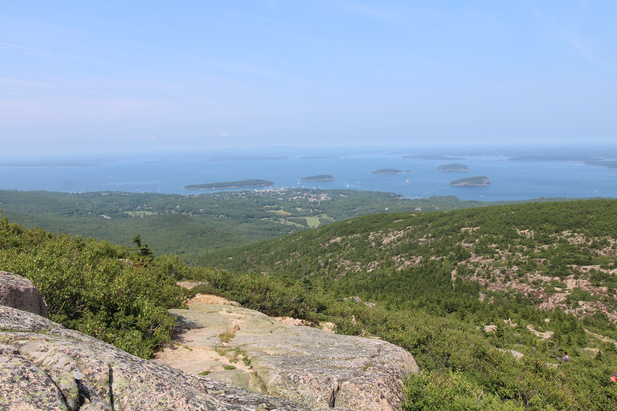
3 After eating, we walked around the summit to get the views of Champlain Mountain and Bar Harbor, then headed back down the mountain the same way we came up. At seven miles roundtrip, the South Ridge Trail is longer than your average casual “hey, let’s go for a hike” kind of hike, but the views really are quite delightful.
There were a couple sections that I would consider truly steep; other than those brief segments it’s mostly just a continuous climb with a little down and up around the Featherbed in the middle. We had pretty good weather, clear skies, a little hazy, not too hot, not too many bugs; the trail itself wasn’t too crowded (the summit was busy, and the store was pretty packed); and all in all it was a great start to our Acadia vacation.
 |
| Views from the summit |
 |
| Bar Harbor, Bar Islands, and Champlain Mountain |
 |
| Descent, looking out to the Atlantic |
1Welcome to 2021, where Instagrammers is a word according to spell check and prefactor and rheometry aren’t. At least the opposite is true in the OED.
2Katahdin takes 8-12 hours to hike, is known for being rough on hiking boots (so just imagine what it would do to soft rubber shoes), and it’s recommended to bring half a gallon of water per person. Baxter State Park also requires every hiker to have a flashlight that’s not your phone and another of the items on their packing list is an emergency blanket in case you get stuck on the mountain overnight. So no, you don’t just waltz right up for that cool money shot on the Knife Edge.
3I’m pretty sure this is a proven scientific fact.