Tuesday, October 5, 2021

Acadia 2021, Day 1 – Cadillac Mountain

Before it became trendy for the Instagrammers1 and hipsters and bandwagon outdoorspeople to pack up their iPhones, $300 backpacks, and brand new hiking boots and take to the hills and dales, my family was enjoying hiking and camping because it was cheap. And fun. I’m absolutely not judging who is or isn’t a “true” hiker, but do it because you like it, not because you want social media clout or because everyone else is doing it. And please, please, do some research and don’t do something like show up to climb Katahdin at 2 pm wearing crocs and carrying a single 8 oz. bottle of water that belongs in an elementary schooler’s lunch box.2 With that said, on to the actual subject of this post.

Part of my trip home was a family vacation to Acadia National Park, in Maine. Acadia is the only national park in the northeast, and even the last time we were there in 2013, the park rangers were already saying that attendance was rapidly increasing. Thanks to social media, covid, and probably some other factors, when we were there this time, it was downright crowded (in certain areas; others weren’t too bad). Still, we had a good trip, and I think I’m happy with my new wide angle lens.

I (somehow?) was allowed to be in charge of planning our hiking excursions, but because I know not everyone’s idea of a good time is hiking all day, every day, we didn’t do anything too crazy. At least in my opinion. Our first hike was up Cadillac Mountain, at 1,528 ft the highest point on Mount Desert Island. Due to the increased crowds, you now have to reserve a parking pass to drive up Cadillac, but hiking doesn’t require a permit. Previously, we hiked Cadillac via the Gorge Trail (up) and the North Ridge Trail (down). We got caught in the rain and got views of nothing but clouds from the summit. This time, we were about to tackle Cadillac from the South Ridge Trail, which is longer but less steep.

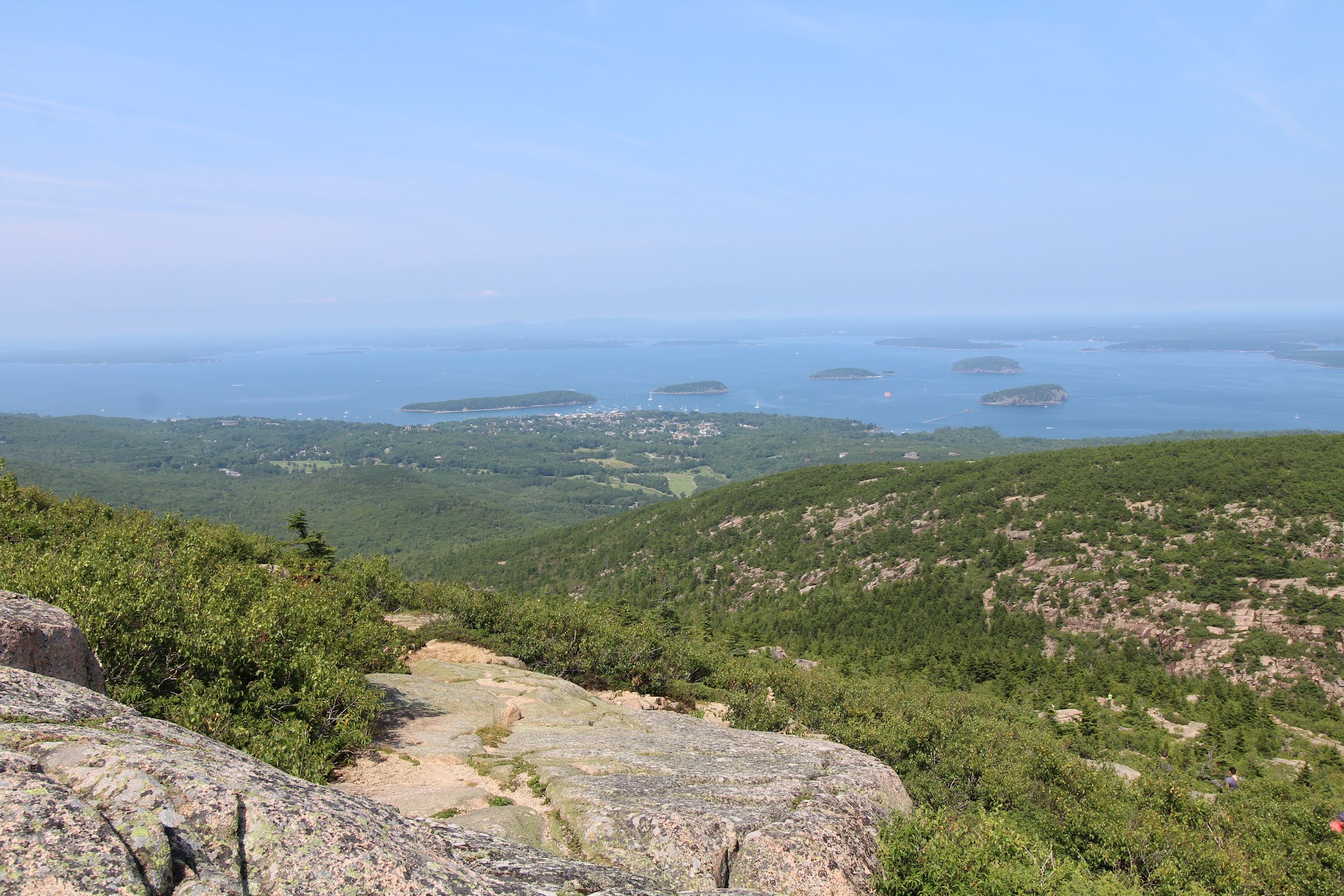
We parked by the trailhead, I made everyone peanut butter and jam sandwiches, and we headed off on our adventure of the day. The first mile+ is wooded and (comparatively) gently sloping. For the next ~two miles, the trail is on rock surrounded by shrubs and small trees. First you follow a long ridge with lovely views on either side (the Atlantic Ocean to the right/east and further into the park on the left/west) and the summit ahead. That’s followed by a short descent down to a little pond called the Featherbed, then an ascent back up to another rock slope. The final half mile returns to the trees (what, you thought any of these little east coast peaks would get above treeline?) and roughly parallels the summit road close enough that you can both hear and see cars, which is a little annoying, but the earlier views more than made up for it.
 
Ascending Cadillac on the South Ridge Trail

The Featherbed

When we made it to the summit area, we found a spot to enjoy the view and lunch. As per usual, the vistas looked better and the meal tasted better because we hiked to get there.3 After eating, we walked around the summit to get the views of Champlain Mountain and Bar Harbor, then headed back down the mountain the same way we came up. At seven miles roundtrip, the South Ridge Trail is longer than your average casual “hey, let’s go for a hike” kind of hike, but the views really are quite delightful.

There were a couple sections that I would consider truly steep; other than those brief segments it’s mostly just a continuous climb with a little down and up around the Featherbed in the middle. We had pretty good weather, clear skies, a little hazy, not too hot, not too many bugs; the trail itself wasn’t too crowded (the summit was busy, and the store was pretty packed); and all in all it was a great start to our Acadia vacation.
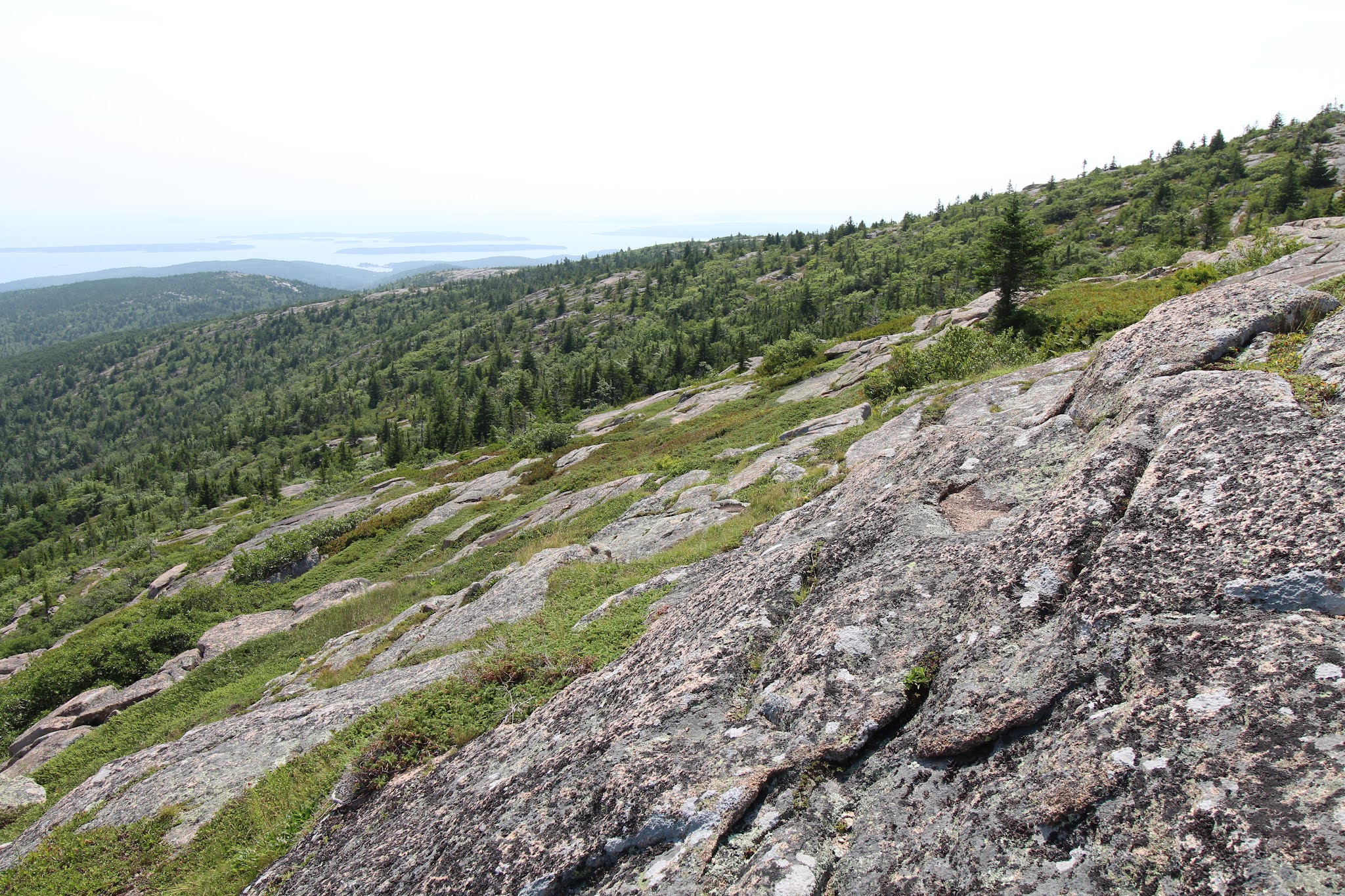
Views from the summit

Bar Harbor, Bar Islands, and Champlain Mountain

Descent, looking out to the Atlantic

1Welcome to 2021, where Instagrammers is a word according to spell check and prefactor and rheometry aren’t. At least the opposite is true in the OED.

2Katahdin takes 8-12 hours to hike, is known for being rough on hiking boots (so just imagine what it would do to soft rubber shoes), and it’s recommended to bring half a gallon of water per person. Baxter State Park also requires every hiker to have a flashlight that’s not your phone and another of the items on their packing list is an emergency blanket in case you get stuck on the mountain overnight. So no, you don’t just waltz right up for that cool money shot on the Knife Edge.

3I’m pretty sure this is a proven scientific fact.

Monday, September 27, 2021

Isolated Hill of Bedrock

From the Encyclopedia Britannica, an “isolated hill of bedrock standing conspicuously above the general level of the surrounding area” is a monadnock.1 The name “monadnock” comes from a Native American word for a mountain higher than and separated from the land around it, such as Mount Monadnock in Jaffrey/Dublin, New Hampshire, our latest adventure on my trip home. Monadnock is said to be the second most climbed mountain in the world, with an estimated 125,000 hikers summitting each year, only behind Mt. Fuji and its approximately 300,000 summitters per year. Its popularity likely stems from its proximity to Boston and a large part of the Northeast in general, its accessibility, and because it can be climbed in less than a day without too much technical ability. No need to drive for hours through wilderness, backpack in, or learn how to use an ice axe. At 3,165 feet it’s not an epic peak2 rearing into the clouds, but its location and vistas make it an attractive destination for New Englanders.

This visit was not our first time at Mt. Monadnock; we climbed it three years in a row from 2000-2002 when my brother and I were much smaller, and once more recently. On this trip, despite my campaigning, compromise led us to leave home in the mid/late morning and arrive at Monadnock just in time to hike during the hottest, sunniest, most crowded hours of the day. We parked at the main headquarters where the majority of hikers begin their climb. Because Monadnock is so popular, it’s recommended to reserve your parking in advance, especially for weekends and holidays, though when we were there on a weekday the parking lot was only mostly full.

From HQ, the white dot trail ascends almost 1,800 feet to the peak in a little under two miles. The first ~half-mile section is wide with stone and log steps built into the trail. Here, there were quite a number of other people, so when the trail forked we turned onto the quieter white cross trail, which would meet up again with the white dot trail closer to the summit. Following a short wooded section, we began ascending rock fields that would be just the first of many. After five years in flatland the Midwest, I’d forgotten how rocky hiking in New England can be. About an hour into our hike, we started getting our first views of the surrounding area.

Rocks on the white cross trail

An hour after that, as the trees thinned and we started walking across more exposed rock, we got our first look at the summit, afar in the distance. Shortly afterwards, we met back up with the white dot trail for the last 300-foot ascent to the top. Although Monadnock’s summit is below the climactic tree line, fires set in the early 1800s to create pastureland and clear out alleged wolves permanently denuded these top 300 feet of trees, generating an artificial tree line and the long barren rock slopes of the final ascent. Thanks to our late start, we arrived at the summit in time for a very late lunch (peanut butter and jam sandwich, clementines, and oatmeal raisin walnut cookies I baked the afternoon before), which we enjoyed in the presence of lovely views and the couple dozen other hikers at the top with us.
 
Summit views

Rocks to the top

On the descent, we followed the white dot trail all the way down many, many stone steps, arriving back at the now mostly empty parking lot in the early evening. The New Hampshire State Parks website estimates the white dot trail to take about 2 hours to hike (one way) and the white cross trail about 2 and a half hours, which I think is pretty accurate if you either hike at a moderate pace the whole time or go faster but stop a lot to take photos. It’s a moderately difficult hike – you don’t need much technical ability (caveat: as long as there’s no snow; Monadnock’s open year round), but the distance and elevation gain make it more than your average stroll through the park. Like, I wouldn’t really recommend the hike to someone who hasn’t walked further than their mailbox in the last year, but if you’re a reasonably experienced day hiker it should be within your abilities.

View from the summit

The descent

Snacks/lunch and water are necessary; I had a liter of water (the park recommends two), which is more than I’ve needed for longer hikes, and I never felt like I was going to run out, but I could have done with a little more. It was hot – in the 80s – and above about 2,000 feet the trail’s pretty exposed, so I’d also suggest hats and sunscreen, plus wear shoes with good traction because of all the rocks. If you hike during peak season, expect plenty of other people, but the mountain’s big enough for everyone. So yes, Monadnock’s popular, but for good reason, and I’d recommend it to anyone who doesn’t mind a lot of rocks and sweat.

1Monadnocks are also known as inselbergs, from the German for “island mountain.”

2The U.S. Geological Survey has no official definition as to what constitutes a mountain as opposed to a mere hill, but geologists often consider prominences more than 1,000 feet higher than their surroundings mountains, the UK government uses 2,000 feet above sea level as their qualification, and the United Nations Environment Programme has a classification system based on sea level, slope grade, and local elevation.

Saturday, September 18, 2021

Double Donuts

While I was at home, my list of things to do was as follows: 1) Go to Wegmans, 2) Eat cake, and 3) Attend a Revolution game. Though I did accomplish all three items on the list, this post is about item number three. The last time I was physically at a Revolution game, Bobby Shuttleworth was struggling in net, Charlie Davies had just been traded to the Union, and the team lost 4-0 to the Philadelphia Union. Since then, on the coaching front, they’ve parted ways with Jay Heaps, hired Brad Friedel, fired Brad Friedel, and lured Bruce Arena to New England; the only players still playing on the team are Brad Knighton, Matt Turner, Andrew Farrell, Scott Caldwell, and Teal Bunbury; and the team has won a single trophy – a preseason mobile mini sun cup, which was indeed mobile and mini. So considering my last Revolution game and the entirety of whatever it was Brad Friedel did for a year and a half, my only wish for this game was that they wouldn’t lose, and if they managed to score it would be an added bonus.

There was reason to hope. Bruce Arena had the team off to an 11-3-3 start through the first half of the season, and their 36 points were good to lead both the Eastern Conference and the Supporters’ Shield standings (I don’t think I’ve ever seen them on top of the Eastern Conference this late in the season, let alone leading the entire league). All three designated players were tallying up goals and assists for the stat sheets – Carles Gil and his 15 assists were on pace to beat the MLS single-season assists record, Gustavo Bou had already hit double-digit goals, and Adam Buksa had eight goals and looked good on the field after a disappointing first season in MLS. Alas, it was not (entirely) to be. The Revolution didn’t lose, but on this Wednesday night in August, they were playing Nashville SC, in the rain, with Carles Gil out injured. It was quite a slog. On the plus side, Gold Cup champions Matt Turner (and Henry Kessler) were back from their time with the USMNT, as was Canadian Tajon Buchanan.1
 
Pregame at Gillette Stadium

When we arrived at the stadium shortly before kickoff, it was already raining. If I’d had more schedule flexibility, I would not have chosen to attend a game against Nashville SC, but here we were. Nashville plays soccer that earns them points, but it can be slightly painful to watch. Combine that with the weather2 and Gil’s absence leaving a creative hole in the center of the field, and it was not a great game to witness.

Soccer in the rain

Bou and Buksa started as the forwards, but they’ve had trouble connecting with each other in the past, as ended up being true on this night. Bou got in a couple shots on goal, but Buksa in particular seems to struggle to score without Carles Gil’s service and presence on the field, though his hold up play and passing have looked significantly improved over last year. In midfield, Matt Polster and Buchanan played centrally with Wilfrid Kaptoum and Arnor Traustason on the wings. Polster was solid, Buchanan did okay for being out of position, I’m still not sold on Kaptoum, and Traustason was mostly ineffective. The defense (DeJuan Jones, Kessler, Andrew Farrell, and Brandon Bye) was somewhere between passable and pretty good (they didn’t let in any goals so I can’t say they were bad), and Turner didn’t have much to do but made his two saves that he had to. [The game ended in a scoreless draw, 0-0, so although New England couldn’t put the ball into Nashville’s goal, they at least got the shutout. You have to take the positives where you can find them, because this was otherwise a very boring game.]

Post final whistle, fans fleeing Fortress Foxborough

The Revolution had a couple okay shots on goal, but nothing that really challenged Nashville’s keeper. There was one penalty call against Nashville that was overturned (correctly) after going to VAR where it was determined that the Nashville defender didn’t actually make contact with Bou. It was very wet, though the rain finally mostly died down in the middle of the second half. The stadium looked nowhere near full, and the scoreline did not cheer up those who did attend. At least the Revolution didn’t lose, so that was an improvement over the last game I went to. Maybe next time I’m at a game they’ll manage to score, and if the stars align and Mercury is rising in the opal quarter with Andromeda in retrograde, they’ll even win.

1Turner played all six games (3 group stage, 3 knockout), let in a single penalty kick goal, and was given the Golden Glove Award. Buchanan had a strong tournament, scored the only goal up to that point against Mexico, and won the Young Player Award. Kessler, on the other hand, was called up to replace an injured player and played the last three minutes of the US’s final game after they’d scored in added extra time, but he still got his Gold Cup medal.

2Rain + midweek = great social distancing conditions. There were allegedly 10,279 people in attendance, but even if that number is accurate, that’s six seats for every fan with Gillette Stadium’s capacity of 66,878.

Thursday, September 9, 2021

On Walden Pond

So. I went home. In April, I received my first dose of Pfizer’s COVID-19 vaccine, and was considered to be fully immunized by the end of May. By June, there were less than 20,000 reported covid cases and 200-300 deaths per day in the US, over an order of magnitude lower than the January/February peak, so I booked plane tickets for the end of July. Of course, by August when I returned from my trip some states would be worse off than they were a year ago without the vaccine, but I appear to have escaped from my sojourns on public transportation mostly unscathed. With students still away for the summer, the Blue Bus I took to get between North and Central Campus and the Michigan Flyer from downtown to the airport were both uncrowded. My flights in either direction were fully booked, with mandatory masking that was mostly adhered to on the Michigan end and almost completely followed on the New England side.

After I arrived home, went to Wegmans, and spent several days lounging on the living room carpet, my brother also made his appearance and we started to take some family day trips, the first of which was to Walden Pond. Yes, that Walden Pond, where Henry David Thoreau went to live deliberately in the woods a whole two tenths of a mile from the road into Concord (to be fair, he directly tells the reader that in Walden, which I do own and had to read parts of during a class I took at Cornell). For two years, two months, and two days from 1845-1847, Thoreau lived in a cabin at Walden Pond on land owned by his friend and fellow transcendentalist Ralph Waldo Emerson. Today, the Walden Pond State Reservation is managed by the Massachusetts Department of Conservation and Recreation and features a beach area, hiking trails, and a replica of Thoreau’s cabin.

Walden Pond

When we arrived at Walden Pond, our first order of business, after parking, was a walk around the pond. The main path from the parking lot leads to the beach area, at the south end of the pond. From there, there’s an unpaved, but fairly flat trail around the pond that’s 1.7 miles long, part of which is a section of the Bay Circuit Trail that connects 37 towns in eastern Massachusetts. About 0.4-0.5 miles from the beach on the eastern side of Walden Pond there are signs leading to the site of Thoreau’s cabin (just the site; his actual cabin is gone and the replica is by the parking lot). Along the trail there are spots where you can access the lake shore, some with sandy areas where people were picnicking, reading, sunbathing, etc. During our circuit we encountered two or three dozen other people, so you were never very far from people but it also wasn’t crowded at all, and there weren’t any large groups blasting music and screaming, thankfully.

The site of Thoreau's cabin (cabin boundaries marked by the stone pillars on the right)

After circling the pond, we took a short walk up Emerson’s Cliff, elevation 289 feet, sadly possibly the highest hill I’d been on since before moving to Ann Arbor. From there, we got a view of nothing but trees (you might be able to see Walden Pond in winter), then descended to Heywood’s meadow, which was more marshy than meadowy. It did contain a beaver dam, and there was a potential beaver sighting, so that was a plus for the marsh meadow. By the time we returned to the parking lot, the visitor’s center was closed, so we went and concluded our visit with a stop by the replica of Thoreau’s one-room cabin. We visited on a summer weekday, and spent a little over 2 hours there. It was on the quiet side of busy, more so on the beach, less so on the trails, especially off the main pond trail. The only cost is parking, with in-state and out-of-state prices, and the parking lot can fill up on nice summer days and weekends, according to the website. Overall, recommended for anyone who wants to pair their hike and/or day at the beach with some history and vague memories of English class.

Replica of Thoreau's cabin

Tuesday, August 31, 2021

Tour de Ann Arbor

When I set out to bike to all five branches of the Ann Arbor District Library in one day, I didn’t realize the Tour de France was going on at the same time, but turns out it was, so that was fitting. On the very first stage of the race, a spectator managed to step too close to the course with a sign and cause basically the entire peloton to crash, which was more or less the big news of the Tour de France. Fortunately, on my journey I was not hit by anything besides a vine that scratched my arm because I biked into it.

During the summer, I normally visit all the library branches in search of summer game points, but usually just one or two at a time. After five years in Ann Arbor, I’ve biked almost everywhere in the city, so for fun I mapped out a route that would take me through all the branches in one trip and realized it was actually feasible. The way the library branches are spread out, the most efficient route roughly circles the city and is about fifteen miles long if you start downtown. Even adding the mileage to get downtown, the whole trip is about as long as some of my rides along and around the Border to Border  (B2B) trail, so I thought, why not?

Setting out, I knew it wasn’t going to be the most pleasant ride, which proved to be true. I picked a time on the weekend when there was less traffic, but the drivers seemed worse than average. Given that during the pandemic lockdowns in Michigan traffic decreased but accidents per mile travelled increased, I wouldn’t be surprised if the drivers were actually worse than usual. Because I had a lot of ground to cover, I took the shortest routes, which included a lot of not-so-great roads for biking.

Library branches, in the order visited: Top right - Downtown, center - Westgate, bottom right - Pittsfield, bottom left - Malletts Creek, top left - Traverwood

The B2B and its connections through Parker Mill County Park and to the Matthaei Botanical Garden Trail are great. There are enough pedestrians on campus and downtown to keep traffic slow and drivers aware enough to make them fairly bikeable. Residential neighborhoods are also fine, and most of the main spoke roads radiating from the center of Ann Arbor have decent bike lanes, but outside of that the biking’s not super fun. Part of the problem is that Ann Arbor has an incomplete interior ring road. It was supposed to move cars around the city quickly, but because it’s so piecemeal it has more intersections, entries and exits (to shopping centers, housing developments, churches, schools, parks, golf courses, etc.), and traffic lights than a ring road should have. This defeats the purpose of a ring road because if you have development along it, it itself becomes a destination and it’s no longer a fast way to circumscribe the city. In fact, the not-ring road makes traffic in the city very messy, leading to the conclusion that I came to after this bike ride.

My primary problem with Ann Arbor is that it can’t decide whether it wants to cater to cars (ring roads, high speed limits, four+ lanes of traffic) or encourage pedestrians and bikers (sidewalks that don’t suck, bike lanes, not almost getting run over by a car every time you cross a street). Take, for example, the not-ring road. It has posted speed limits of 35-40 mph, which is too fast for bikes to keep up with and not fun for pedestrians to walk next to. However, the not-ring road has (not great) sidewalks because of its proximity and direct access to public services like schools and grocery stores that people without cars might conceivably need to get to. So the not-ring road sucks for pedestrians/bikers that need to access things along it because it’s noisy and terrible to walk/ride along, and it sucks for drivers because it’s riddled with traffic lights, crosswalks, and turn lanes. Overall it sucks for everyone because it’s not particularly safe for anyone.

I was on Reddit awhile ago and in some post about biking (probably related to the Tour de France crash) someone posted an interesting link to a video that addresses this topic. In the video, they define a road as a “high-speed connection between two places” and a street as a “complex environment where life in the city happens.” The problem, they argue, is “stroads,” which try to combine streets and roads but don’t properly do the job of either. Sounds a bit like the not-ring road that I had to bike on to visit all my library branches. Anyway, in the end, I got my summer game points, some exercise, and only a scratched arm, so I guess it was worth it.